Cradle Mountain National Park

A place of spectacular natural scenery, iconic mountain views, alpine flora, endangered fauna, wild weather and world class hikes. We’re camped right in the heart of the Tasmanian Wilderness World Heritage Area.

A Global Treasure

We have been fortunate to have had the opportunity to explore some very special places during our travels together; Yosemite National Park, the Grand Canyon, the Canadian Rockies, the Isle of Skye in Scotland, Arnhem Land in the Northern Territory and the Pilbara of Western Australia to name just a few. But this week we have had the privilege to explore yet another region of the world that truly belongs in that very special category of rare, natural treasures – Cradle Mountain – Lake St Clair National Park, Tasmania.

Dove Lake at Cradle Mountain – Lake St Clair N.P.

The iconic Cradle Mountain, originally named Ribbed Rock for its long, narrow and jagged ridge line, was made popular shortly after the early explorers Gustav Weindorfer and his Tasmanian wife Kate settled here and opened a guest house in 1912. They played a key part in having Cradle Mountain declared a Scenic Reserve and Wildlife Sanctuary in 1922, extended in 1927 and finally, in 1971, the reserve became what we now know as Cradle Mountain – Lake St Clair National Park. Then in 1982 the National Park, along with four others, achieved a truly protected status when it was registered on the World Heritage List.

“This must be a National Park for the people for all time. It is magnificent, and people must know about it and enjoy it”

Gustav Weindorfer 1910

Unpredictable Weather

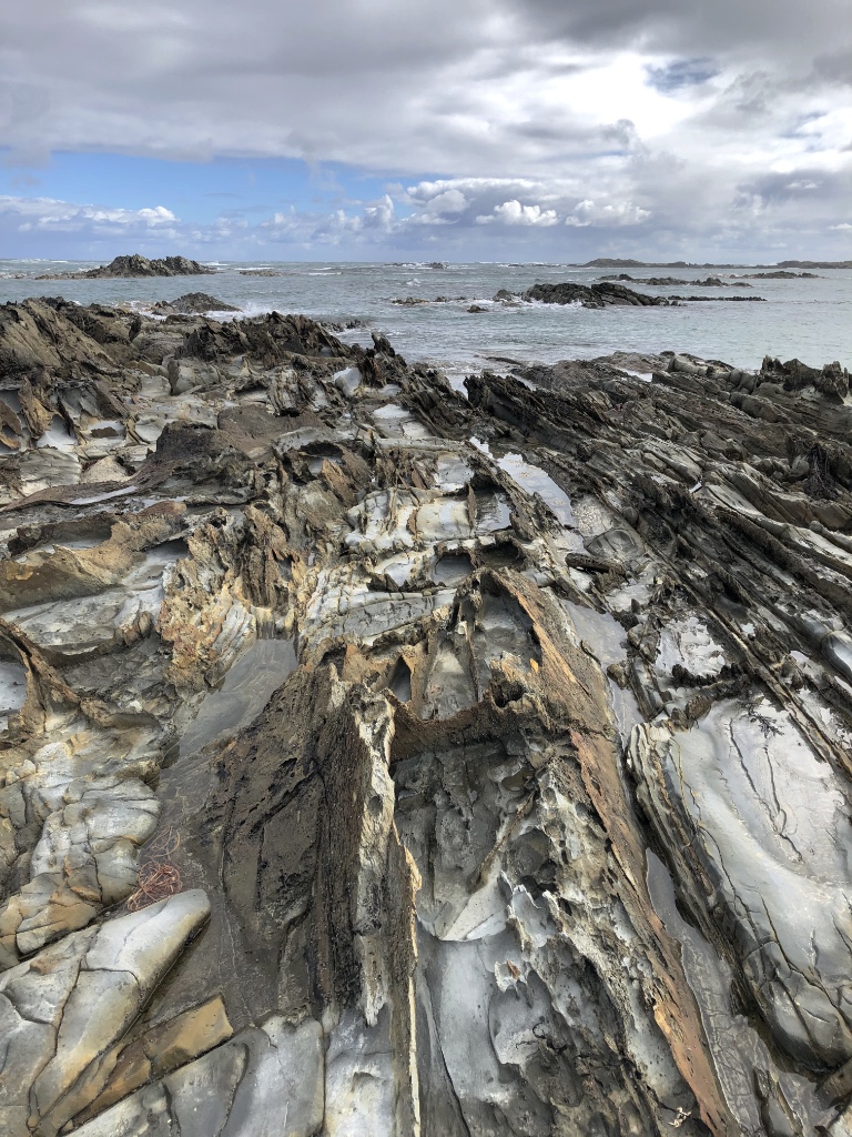
Now, many will know that Tasmania is subject to somewhat variable weather sitting, as it does, 250km off the south coast of Australia fully exposed to the wild weather of the ‘roaring forties’. But here in Cradle Mountain variable could mean a glorious sunny day one day and snowing the next – even during summer. With 3-metres of rain each year it’s a place where you need to pack well, dress in layers and hope for the best.

Quick, the Sun’s Shining!

We’ve had some cool but glorious sunny days since our autumn arrival in Tasmania and our luck was in as we arrived at Discovery Parks Cradle Mountain campground*. As soon as we had parked up we raced to the visitor centre just a few minutes away to get our bus passes. On our last visit here you could drive right to the edge of Dove Lake – the main day visitor viewpoint of Cradle Mountain. Now, however, access is via a shuttle bus with several drop-off points on the way before arriving at the well designed terminal facility.

A short walk leads right down to the lake with staggering views, and on this day, a rare near cloudless sky. We couldn’t have hoped for better. We had considered taking the circular walk around the lake but it was getting late in the afternoon and, with a predicted change of weather on the way, we chose to walk around to a second popular photo spot – Dove Lake Boat Shed.

There’s always one

For some reason some people do the most selfish thing without any care in the world. In this case a man decided it would be good to strip to the waist and sit in the water right in front of people trying to take a photograph of the scenery. It’s a vast lake. Why right here? Nutter.

Dove Lake Boat House

Eventually he gave up and those that had the patience finally got the opportunity to record a moment in time of this classic scene. It was the Easter holidays and there were many people around, but every now and again you could capture a shot as hikers passed behind the boat house or one of the low growing trees.

Not long after taking several photographs we noticed smoke drifting across the mountain. A change of wind direction was bringing smoke over from a nearby burn-off and it signalled a change of weather ahead. It was time to make our way back.

Smoke driving in from a burn-off

A laugh a Minute

Our shuttle trip back to the visitor centre was a very memorable one. Our driver, J Dub, as he liked to call himself, was a laugh a minute describing, with dry humour, his escapades among the mountains, tripping over tree roots and planting his face in mud only later to discover his animated eyebrows were leeches making a meal of his face. We hoped he would be driving our next shuttle over the following days.

A change of Weather

As unpredictable as the weather is here, the forecast for the next few days was pretty grim with rain moving in from the north and temperatures plummeting as a southerly takes hold. Even snow was expected. We decided a drink at beer o’clock was in order as we discussed plans for tomorrow.

Wasteland

* The site was undergoing a major redevelopment and in places looked as though a tornado had recently passed through. The park had hoped to be finished by now but work had been delayed as a result of Covid.

Fire at Don River Railway

We were said to learn of a serious fire at Don River Railway near Devonport this morning. Only last week we we’re enjoying a ride on one of the steam trains between the Don River and Coles Beach: Letting of a Little Steam

Fire crews from Devonport, Burnie and Latrobe were called to the blaze in the early hours this morning. Around 30-fire fighters from local stations arrived to find three of the sheds ablaze leaving the volunteer rail team, who had spent thousands of hours restoring several carriages, devastated.

More from the ABC: Fire at Don River Railway

The Other Tarkine

Yesterday we were exploring among the forests of the Tarkine but there’s more to the region and there could not be a greater contrast.

The Wild West

A substantial section of the west facing northwest coast is within the Tarkine boundary and offers just as much drama as the forests to the east.

Couta Rocks

Couta Rocks

Nothing quite prepares you for the wild and dramatic view as you climb above the dunes a few hundred metres north of the beach shacks at Couta Rocks. Crashing waves add even more drama to the windswept beach. Many of the rocks are razor-sharp and brittle so care is needed navigating your way among them.

Following the clearly defined path we rounded the dunes to be greeted by a sweeping bay with scattered driftwood, seaweed and a few poisonous Bluebottle jellyfish. Someone had built a beach shelter nearby held together with kelp seaweed but probably not the best protection from the squalls and gusting winds blowing in from the Indian Ocean. But the weather does lend itself to photography as long as you can stand your ground against the wind.

Access to Couta Rocks is along a rutted gravel road but, taken carefully among the potholes, most vehicles will have no trouble reaching the sea.

Nelson Bay

A little further north along the C214 – Temma Road is Nelson Bay. Again access by a gravel road should cause no issue for smaller 2-wheel drive vehicles but leave the caravan behind. The road terminates at a small gathering of homes overlooking the wild sea with plenty of flat ground to park. A short stroll south leads to a path to the beach and again wild seas are crashing over the rocks further out in the bay. Here erosion has created curious formations with jagged rocks standing upright and certainly capable of severe injury if you were to fall awkwardly.

Nelson Bay

It’s the kind of place you could spend hours staring out to sea, if you hadn’t frozen by then, and coincidentally someone has conveniently mounted a chair right among the rocks so you may do just that. On a calm day this would be a great place to chill but on our visit further rain was racing in from the sea and it was time to take cover.

A chair with a view

Tomorrow we retrace our steps back to the north coast but we’ll miss the tranquility the Tarkine has given us over the past few days. We’ll always remember with great affection what a very special place in the world this is.

The Tarkine

The greatest expanse of cool temperate rainforest in Australia and the second largest in the world, the Tarkine is a massive wilderness region covering much of the northwest of Tasmania.

Wet and Wild

Walking through the rainforest on a damp, showery day is like walking back in time through some mythical ancient forest. And it is with good reason, the Tarkine is a rare remnant of Gondwana, a true and ancient wilderness. It is a land of tree ferns, lichens, mosses, fungi, rare and ancient trees and abundant wildlife including the endangered Tasmanian Devil.

Tarkine Tree Ferns

Our visit followed the Tarkine Drive, which takes a circular route through the northwest of the region. Largely black-top ‘C’ grade roads but giving way to gravel tracks to visit many of the highlights. All are passable in sturdy two and four-wheel drive vehicles but there are numerous potholes to navigate.

Trowutta Arch State Reserve

Our first stop was at Trowutta Arch State Reserve and what an amazing walk this was with an unexpected and startling view of the arch. The relatively* easy 30-minute return walk takes you among giant Myrtle Beech trees as well as Leatherwood, Sassafras and Celery-topped pine trees, while in the undergrowth tree ferns, native laurel, brackens, fungi, bright green mosses and algae create a dense forest floor.

Every now and then we spotted what appeared to be white leaves laying on the forest floor and were puzzled where they came from. We later discovered, thanks to a very knowledgeable Park Ranger, that they were flower petals from the famous Leatherwood tree. And it is a tree full of surprises. Very slow growing and only 10-20 metres tall, the Leatherwood tree doesn’t flower until it is at least 70-years old and doesn’t reach it’s peak until 120-200 years of age. Leatherwood is the most common form of honey in Tasmania and accounting for nearly 75% of production. It has a strong and intense floral taste and is easily recognisable among other native honeys. Not surprisingly the Tarkine is one of the major regions beehives are placed during the flowering season between spring and summer. We were lucky to still find Leatherwoods flowering in early autumn.

Giant Myrtle Beech tree

It’s impossible to walk past one of the Myrtle Beech trees without straining your neck and gazing upwards to the crown. They are absolutely straight and void of limbs until reaching the canopy tens of metres above the forest floor. It’s easy to see why loggers were keen to exploit these ancient trees. Thankfully now we are more concerned about the environment and majestic trees such as these are left to grow old gracefully. However, that may not always be the case.

A valuable resource

Unbelievably the Tarkine is not adequately protected with the Tasmanian government seeing this region as a resource to be exploited for timber production and mining. That is despite expert recommendations, commissioned by the government, that it should be protected from any further development. The only way to guarantee this wilderness is preserved for future generations, and for the sake of the wildlife that live there, is to get the whole area under World Heritage listing status. This is a growing, and angry, voice campaigning to protect the Tarkine. Let us hope they succeed.

Trowutta Arch

No assuming you haven’t tripped over one of the many tree roots or falling backwards trying to see the top of the Myrtle trees, you will soon, and suddenly, come across a dark, gloomy hole in a cliff face. But right in the middle is a large, luminous green soup of algae surrounded by fallen rocks and tree ferns. It is spectacular, otherworldly even. I try not to look at the photos in guide books – it spoils the surprise, but I could not even begin to imagine this scene. It has been the highlight of our trip to Tasmania… so far.

Morons

Sadly there are those who enjoy such beautiful scenery as this that they feel a desperate urge to deface it with graffiti or scrape their name into the rock. Here it is more evident than any landmark we have seen in all our travels around Australia. Why do such mindless morons do this? Not only is this action illegal, no one but themselves are the slightest bit interested in seeing someone else’s name. Maybe they should remember that they can easily be traced – they gave their details when buying a Parks Pass after all – duh! … assuming they bought one.

Watch out – a Sinkhole!

Much of the region lays on top of a limestone plateau from aeons past when the Tarkine was underwater. Common to many areas around the south of Australia, acidic erosion creates underground caverns and often these collapse over thousands of years to form sinkholes. The Tarkine is not a immune to this form of erosion and many sinkholes have formed. Some are just shallow depressions but several have filled with water supporting a wide range of aquatic life. One such sinkhole sits right beside the road between Rapid River and the Milkshake Hills. Drive to fast and you’ll miss it. It’s well worth stopping to take a look but don’t step too close to the water – the ground is very soft.

Julius River

From the car park there are two walks, the shorter being just a 20-minute circular route beside the Julius River. This path begins on an excellent raised walkway with viewing platforms as you follow the river before dropping to a bush walk. Here you may see Platypus if you’re lucky.

Coral Fungi – Clavulinopsis sulcata

The trees along the walk are hanging with old man’s beard and there are a multitude of algae and parasitic ferns thriving on decaying branches. Also common during the autumn are a wide range of fungi, many brightly coloured and standing out among the fallen leaves and twigs and others such as puff balls arranged in small piles.

Puff balls – Lycoperdon pyriforme

Further along the walk the ascent becomes steep and the parks Service have built a series of very sturdy but narrow steps. These aren’t for those unsteady on their feet or those with a fear of heights. Beware, there are no handrails on most of the steps on this walk. There were plans to add handrails but apparently the parks service had reached the limit of their budget.

At this point the track becomes harder to follow but if you look carefully you’re see some red markers to the left on a tree and subsequent white-topped posts beside several small depressions will guide you to an old downhill track to the car park. But not before one final series of exposed downward steps, which some may find challenging without a handrail.

Sumac Lookout

Our final stop in the Tarkine was at Sumac Lookout. You can’t miss it – there’s a very large ground level sign carved-out with a chainsaw. A small parking area leads to a short stroll to the lookout point high above the Arthur River and an amazing view it offers in all but heavy rain. We were lucky the showers had eased and the sun was trying to break through.

Arthur River from Sumac Lookout

We had thoroughly enjoyed the day exploring this beautiful unspoilt region of northwest Tasmania, exceeding everything we had expected by a long margin. It had been a cold, blustery day but the weather just added to the atmosphere. This was the Tasmania we had really hoped to see and we were amply rewarded.

* A large part of the walk is among tree roots, which are a trip hazard as well as slippery when wet.

At the Edge of the World

Still batted by strong winds, we’ve moved further west, as far west as we can go in Tasmania – we’ve reached the Edge of the World!

It’s Wild

The northwest of Tasmania becomes ever more remote the further you head west until you reach the Indian Ocean. It can be a wild place with strong winds and heavy rain sweeping across the ocean until it hits land. Suitable for cattle farming and little else as witnessed by the enormous number of dairy cattle dotted across the rolling fields.

Edge of the World

This is no place for townies. It is a place for the lover of the outdoors, the wet weather and muddy boot brigade, the adventurous who wish to explore the wilder places of this world. It’s where the roaring forties makes land. This really is the Edge of the World – literally. It says so on the map.

Looks can be deceiving

Located on Gardiner’s point beside Arthur River, the driftwood strewn beach is testament to the wild, unpredictable weather in the northwest. From this point looking out west the next landfall is Argentina.

Looks can be deceiving, though. We were fortunate on our visit, the sun occasionally appeared between showers and the 45kmh gusts were a mere breeze in comparison to the dark skies and gales of the Indian Ocean at its worst.

A bronze plaque stands with its back to the sea cast with the following inscription by the late Brian Inder:

THE EDGE OF THE WORLD

North West Coast Tasmania

I cast my pebble onto the shore of Eternity.
To be washed by the Ocean of Time.
It has shape, form and substance.
It is me.
One day I will be no more.
But my pebble will remain here.
On the shore of Eternity.
Mute witness for the aeons.
That today I came and stood.
At the edge of the world.

Brian Inder

Brian and his wife Laura created Tasmazia, one of the world’s largest maze complexes – and the Village of Lower Crackpot – at Promised Land in the 1980s.