There’s nothing particularly interesting about a wall unless, perhaps, you are a builder, an architect or Humpty Dumpty. But what if that wall was 100-metres long by 3-metres tall and intricately carved by hand? Curious? We were.
The Wall in question is just a few kilometres from Derwent River, not the river but a curiously placed lodge and a couple of scattered houses in what could best be described as a remote settlement. Here stands a large black sign with ‘The Wall’ written in an impracticality small font, this is your roadside guide to this curiosity. Not the most eye-catching sign and so easily missed, but to drive on past and miss this extraordinary display would be a travesty. The Premier of Tasmania described the Wall as ‘of world significance’. You see, this Wall is something very, very special.
Watch out for Bugs
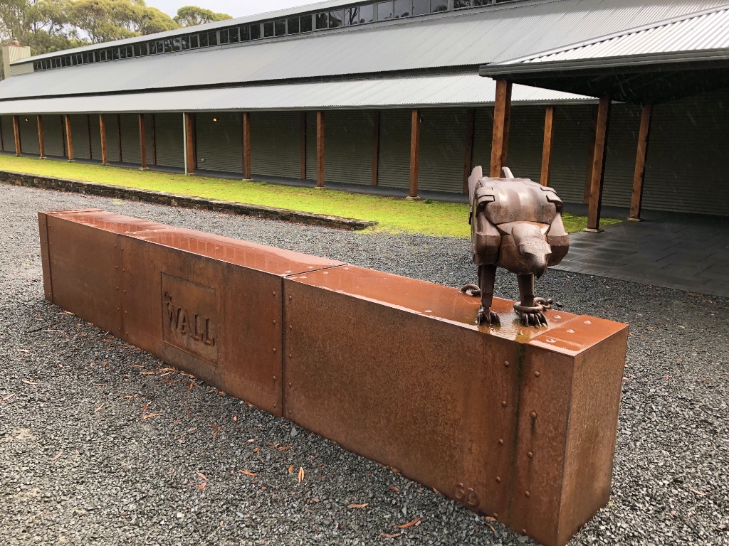
Several large metal sculptures depicting native insects have been mounted on posts as you follow the driveway to the Wall, each constructed very creatively from gas cylinders. And right outside an unusually long, windowless timber and corrugated steel building is a large and substantial rusting steel bird of prey keeping guard on what lurks behind these grey unassuming walls.
Prepare to be Gob-smacked
An impressive doorway leads into a stunning reception area with a timber-clad vaulted ceiling and an enormous, steam-punk style, steel fireplace – a work of art in itself. But turn to the left and follow the black arrows on the floor and you’ll be left speechless. Not only is this a huge, beautifully crafted, timber-framed building but leading along the centre of the building is the most incredible 100-metre long series of exquisite panels, hand carved from Huon Pine, depicting the arrival of the Europeans in the Tasmanian Central Highlands all the way through to modern times.
The detail of the carving, the realism of every fold and crease in a piece of leather and the pose of the animals, insects and human characters is beyond belief. Many of the carvings link from panel to panel, some partially complete to show the process, but all carefully lit to give an amazing three-dimensional sense of depth to a panel only centimetres thick.
All together the carved panels, each a metre wide by three-metres tall, create the 100-metre back-to-back centre of this unusually long gallery. It is all the decade long work of the self-taught creative genius Greg Duncan.
Greg, born in Belgrave in Victoria’s Dandenong Ranges, turned his fascination of woodcarving into a full-time career in 1982. Moving to Tasmania in 1994 and running a successful studio south of Hobart for nine years, Greg and his wife Marg, relocated to Derwent Bridge in the Central Highlands in 2003 to fulfil his ambition of creating a large scale work that would eventually be housed in a custom designed gallery and open to the public.
Greg Duncan – Creator of The Wall
We visited on a cold, showery day and the two handcrafted steel fires were greatly appreciated, not just for the warmth they provided but to admire the skill of their creators.
NO Photography!!
Greg makes it quite clear that photography of the wall is not permitted – you cannot miss the signs! It’s a pity, though, that you cannot share your visit with family and friends but he makes a fair case. He owns the copyright and to make a copy, even just a quick snap, would be disrespectful to ‘the artist’, in Greg’s words. Proceeds from entry tickets are also a source of income – something he truly deserves after 10+ years of hard work.
An on-site cafe and bar provide refreshments and a gift shop selling artworks and other Tasmanian crafts. Check opening times for the gallery as it closes during the winter (June, July and August). Advanced bookings are requested to help control the number of people viewing at any one time. Online bookings receive a small discount.
Once a busy port for Macquarie Harbour, Strahan (pronounced ‘strawn’) is now best known as the cruise gateway to the Tasmanian Wilderness World Heritage listed Lower-Gordon River.
Our cruise takes in Macquarie Harbour, the much feared Hells Gates – access to the open sea, the convict prison of Sarah Island, and a glide along the mirror finish of the lower Gordon River to Heritage Landing. In all the cruise lasts around five and a half hours depending on the weather.
Hell’s Gates
Access into Macquarie Harbour – an enormous inland sea – was first discovered in 1812 and within a few years loggers were taking advantage of the ancient Huon Pine trees, which were ideal for ship building. The loggers, and then early settlers, risked life and limb to cross the narrows of the entrance to the harbour and for good reason it became known as Hell’s Gates. Huge waves and strong winds often made access impossible leaving ships waiting in rough seas until the weather eased or, as happened to many, ended up capsizing with tragic loss of life.
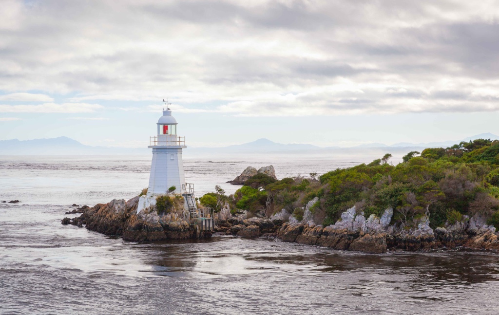
Entrance Island Lighthouse
A signal station manned by convicts was constructed in 1822 to guide ships into the harbour and later, in 1891, white timber lighthouses were constructed, one on the western side of Entrance Island, and the other on Bonnet Island. With the increase in traffic and shipments of ore and timber to and from the harbour, larger ships were needed, which resulted, in 1909, of the purchase of a dredger to deepen and maintain the channel for safe passage.
Entering Macquarie Harbour by ship is much safer today with motorised vessels, accurate maps and satellite navigation but is still treated with great respect.
Just beyond Hell’s Gates is the region known as the ‘Roaring Forties’ – the 40-degree line of latitude that spans the oceans all the way to South America. With no intervening land there is nothing to calm the strong winds and ocean currents, which often pummel the shores of western Tasmania.
Sarah Island
Turning around we headed back through the harbour towards Sarah Island. From 1822 until 1833 Sarah Island was a Penal Settlement with an appalling and much feared reputation. Records show Sarah Island was by far the most brutal of all penal settlements in the history of transportation to Australia. Flogging was a very frequent form of punishment and in one case a convict received 100-lashes in an hour – five of those after he was already dead, just to make sure I guess. His crime? Stealing a small quantity of fat. He was lucky, if he had survived he would have been put in irons for 6-months.
Sarah Island
Convicts were put to work each day, mostly felling Huon Pine trees for shipbuilding back on Sarah Island. They were given just a bowl of oats soaked in water for breakfast but no further meals while they worked to discourage them from absconding. That didn’t always deter convicts trying to escape, though. Some tried their chance escaping into the bush, preferring likely death trying to gain freedom rather than suffer further on the island. Many, though, were recaptured and returned to face 100-lashes.
The ship that Never Was
One such attempted escape involved the theft of a ship that had been constructed in 1834 by convicts on the island. The ‘Frederick’ was the last of over 100-ships to be built on Sarah Island and was due to be sailed to Port Arthur. Ten convict shipwrights boarded the ship and made their way to Chile in South America. Four of the convicts were recaptured and returned to Hobart to face trial on piracy charges. They proved that the ship had never been completed or officially registered and as such did not officially exist, therefore it could not officially have been stolen. They were never convicted of piracy but were charged with the lesser charge of robbery.
Just Ruins
Little of the settlement has survived the ages, ravages of the weather and the occasional pilfering by tourists. But was does remain leaves little impression of just how much of the island was originally built on and just how quickly the vegetation has reclaimed it.
All together around 1200 prisoners spent time on Sarah Island for offences committed while already under sentence. Of the 112 men who attempted escape 62 died in the bush and 9 were eaten by their companion escapee’s.
And talking of eating… lunch was served as we continued the cruise across Macquarie Harbour making for the Lower-Gordon River.
Such was the impenetrable nature of the bushland lining most of the harbour it was hard to tell where the river entrance began. It was only as the rising, densely forested hills began to narrow-in and the slowing of the boat’s engines, could you tell we were now cruising on the Gordon River.
Perfect Weather
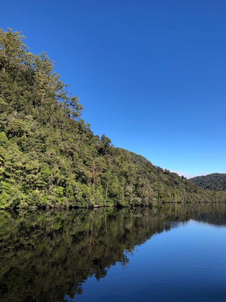
We have been so fortunate with the weather. After the cold and wet weather at Cradle Mountain, today sun is shining from a clear blue sky with just a light wind to break the surface of the river. Occasionally, when conditions are right, early morning mist rises from the surface of the river and the dark, tannin stained water creates a near perfect mirror. It is these reflections, often seen in photographs and travel documentaries, that I was hoping to capture.
Creeping along the river you cannot help but be awestruck by the extent of trees clinging to the hills and cliffs with barely room for anything else to grow. From reeds along the riverbank, trees that have fallen into the river and upward through dense stands of leatherwood, sassafras, myrtle and the infamous Huon pine trees. It’s a true wilderness, untouched and impenetrable.
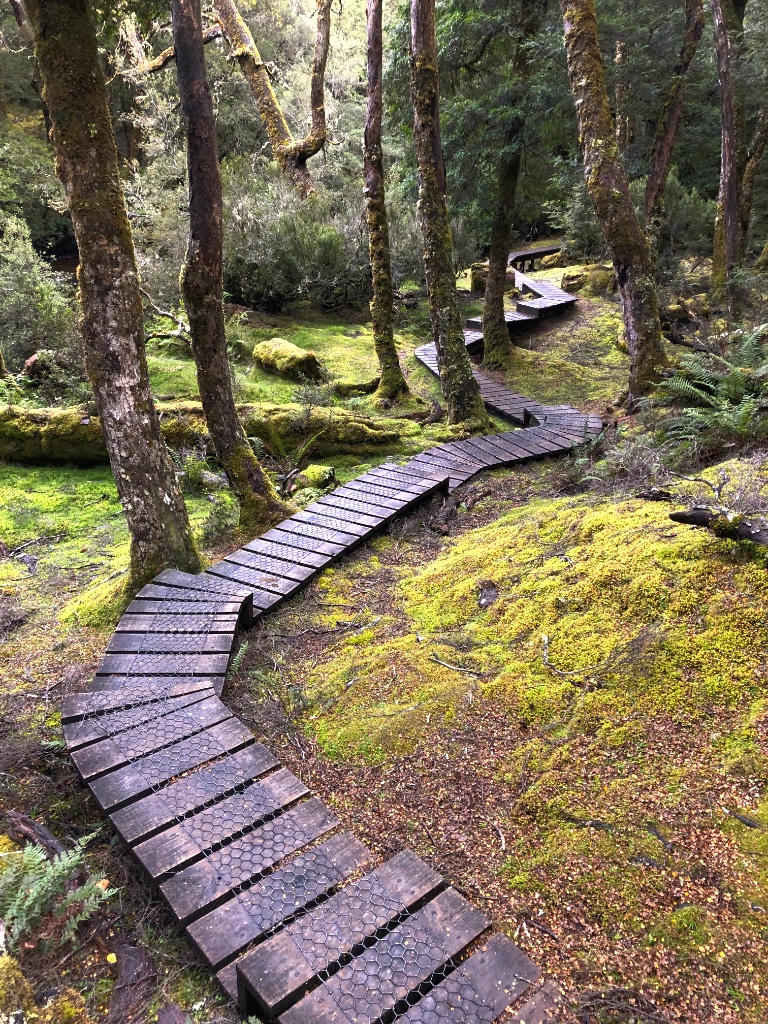
Heritage Landing
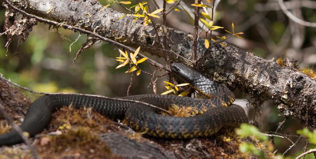
The cruise gives the opportunity to briefly explore a small area of the wilderness at a jetty and boardwalk known as Heritage Landing. Before stepping on land passengers are reminded that there are black tiger snakes in the area and to keep well clear. If proof were needed, in 2008 we visited the same spot and sure enough, right by my side, a tiger snake slithered along a fallen branch and curled-up to take advantage of a patch of sunlight. Apparently, according to our guide, its name was ‘Sammy’.
‘Sammy’ the Tiger Snake
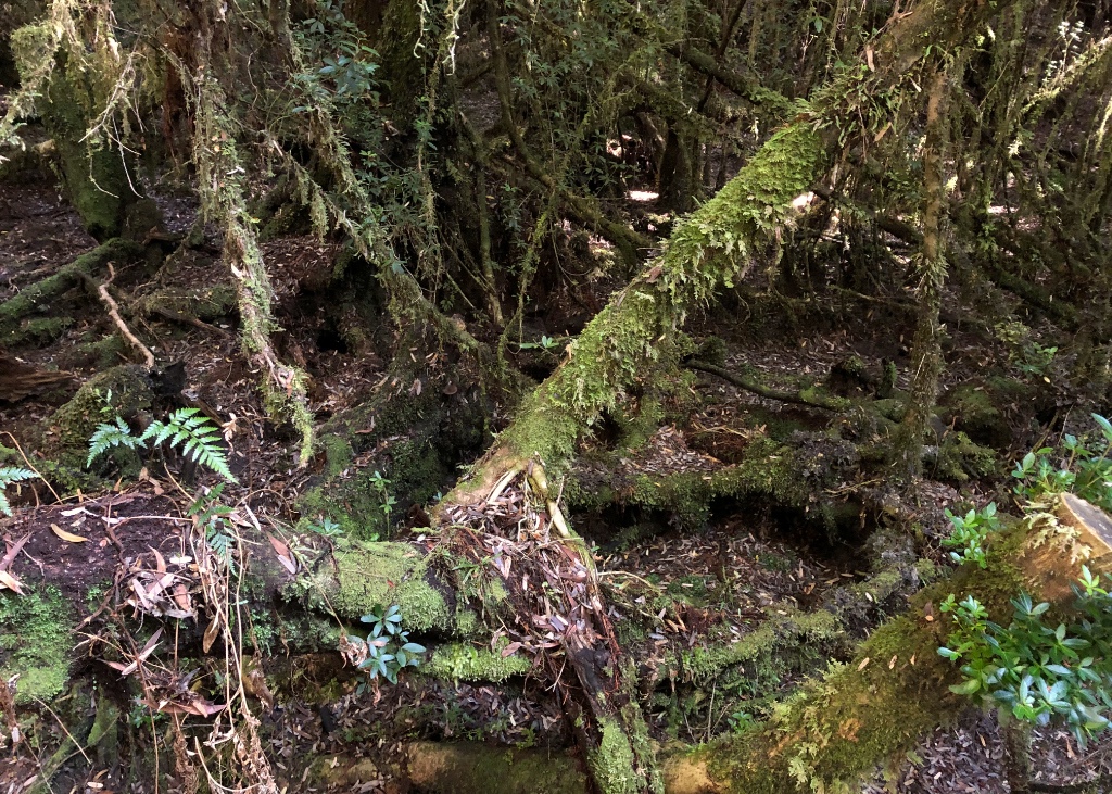
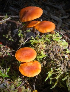
Unfortunately there were no snakes this time as we circled around the boardwalk. Similar to the wooded walks around Cradle Mountain, masses of moss and lichen smothered the ground with brightly coloured fungi growing from rotting branches.
Heritage Landing
All too soon we were returning along the river for the long sail back to Strahan but not before we got the chance to witness the perfect mirror reflections that we had been hoping for.
Gordon River reflections
It had been an excellent day trip among magnificent scenery in the most perfect weather. The only thing lacking was the ‘mood’ of our previous visit when the weather wasn’t quite so enticing. Don’t let a dull grey sky or rain put you off taking this cruise, it will just add more drama to this rare and unique place on earth.
Dam Busters
It’s not possible to talk about the Gordon River without mentioning how close we were to having this unique wilderness lost forever.
In 1978 the Tasmanian Hydro Electric Commission (HEC) announced their intention to build a dam below the confluence of the Franklin and Gordon Rivers called, unsurprisingly, the ‘Gordon below Franklin Dam’. This would have permanently destroyed the unique nature of the wilderness and it quite rightly caused an outrage. We have Bob Brown, the leader of ‘The Wilderness Society’ to thank for raising global awareness of the proposal, which led to 10,000 people in June of 1980 to march on the streets of the Tasmanian capital – Hobart in protest.
Under the then premier of Tasmania, Doug Lowe, an agreement was made to place the Franklin River in a new ‘Wild Rivers National Park’. Then in 1981, caves containing Aboriginal hand stencils and stone tools were discovered, which were estimated to be 8,000-20,000 years old. Additionally concerns began to be raised regarding the potential loss of habitat for endangered species.
Later the same year a referendum was held in which there was a majority in favour of the proposed dam. Still, 33% of voters wrote ‘No Dams’ on their ballot papers in protest. In mid 1982 a change of government chose to go ahead with the dam. The new premier, Robin Gray, commented the river is ‘nothing but a brown ditch, leech-ridden and unattractive to the majority of people’.
The Australian federal government offered $500 million to the Tasmanian government to stop the dam, which was rejected claiming the dam was a matter of the state government and not federal. From that point the anti-dam campaigns stepped-up a gear and were joined by David Bellamy, a renowned UK botanist and nature TV presenter, and Australia’s businessman and adventurer, Dick Smith.
What followed were thousands of people protesting, attempts to stop the dam construction by a flotilla of boats on the river, many arrests and eventually High Court action taken against the Tasmanian State government by the newly elected federal government under Bob Hawke. On the first of July 1983 the High Court judges ruled in favour of the federal government and construction of the dam was finally stopped once and for all.
World Heritage Listing at Risk
The Tasmanian Wilderness World Heritage Area, which includes the Franklin and Gordon rivers, was added to the World Heritage list in 1982 with additional areas coming under protection over the following years. However, politics being what it is, the government, under Tony Abbott, couldn’t stop meddling and in 2014 proposed de-listing the Tasmanian Wilderness as a World Heritage Site to allow logging of trees within the protected area. This was formally rejected by the World Heritage Committee and in 2016 the Tasmanian government withdrew their bid to allow logging after a UNESCO report opposed the idea.
How long before the governments try this again and ignore those that put them in power? They’ve already done just that in the Tarkine.
When there’s a mountain between you and where you want to go, why go around it when you can just dig your way through. It’s not as if miners aren’t used to making holes. But what if you then realise it wasn’t wide enough?
The Silver Lode
In the mid 1800’s the town of Zeehan was just a small mining town near the west coast of Tasmania but it was about to become one of the richest sources of high grade silver of its time and become known as ‘Silver City’. Named after the Dutch explorer Abel Tasman’s ship – the Zeehaen, the town’s fortunes changed after the discovery of silver-lead ore near Mount Zeehan in 1882.
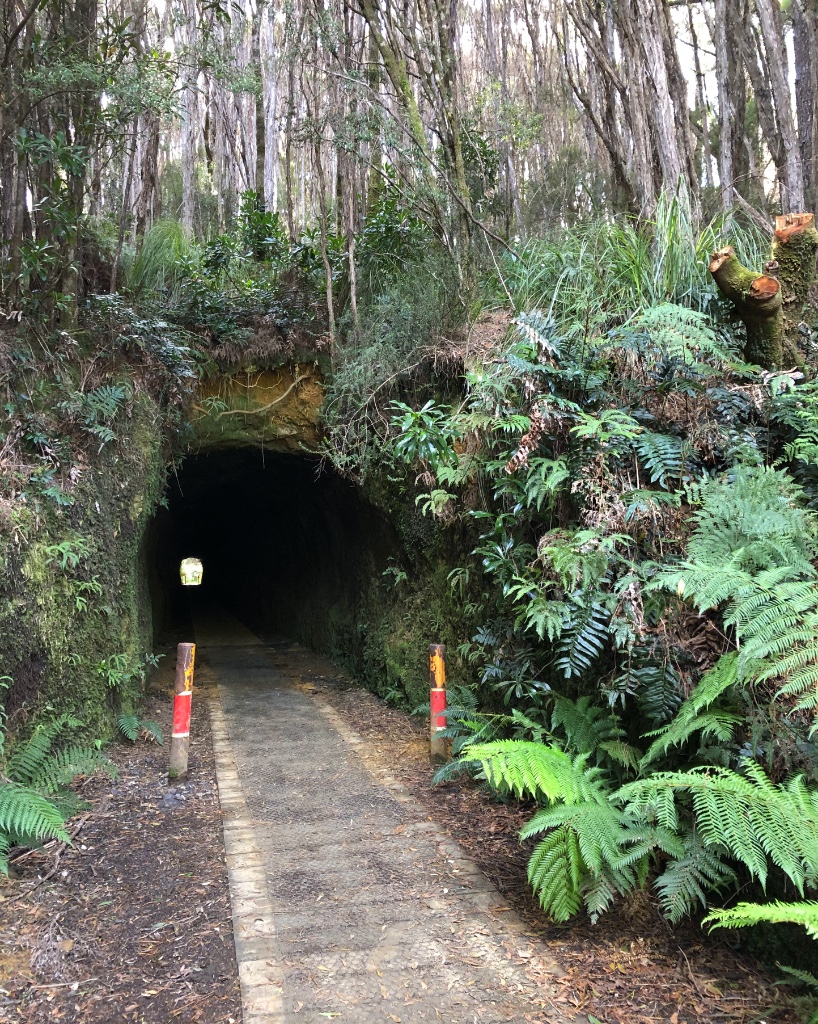
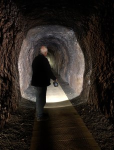
Spray Tunnel
Mining prospector E. J. Freeman developed the mine sites under the Silver Spray Mining Company in 1889. Just a few years later the mine was taken over by the British company Mount Zeehan Silver-Lead Mines but access to and from the mine was slow and expensive. A search for a cheaper form of transport was required. This lead to the construction of a network of narrow tram lines and the tunnel known as Spray Tunnel.
Close to the tunnel’s entrance a 100-metre shaft was sunk (later extended to a depth of 140-metres). To extract the silver-ore from the mine, steam-powered winding gear and the headframe needed to be constructed but this lead to a problem – the tunnel was too narrow for the steam boiler to be transported from Zeehan. The solution was to increase the height at the top and width of the upper sides of the tunnel giving it its classic keyhole shape.
Rich Pickings
With the right equipment in place the mine became hugely successful producing 50,000-grams of silver per tonne of ore. By comparison to today’s modern silver mines a high yield of 30-150-grams per tonne is considered rich pickings.
Now all that remains of the site is the concrete plinths/pads from the shaft winding gear, a 140-metre deep water filled hole, a 100-metre tunnel and a bronze plaque describing the mine’s short but highly successful history.
As you leave the mine, keep a lookout on the left for few of the original steam boilers that have been mounted beside the Zeehan golf course.
A faint Glow
The Tunnel is located right beside the parking area and has a well constructed timber pathway. The only illumination comes from the daylight entering either end of the tunnel but at night you may see the faint blue-white light of glowworms dangling sticky threads from the roof of the tunnel trying to attract and catch passing insects.
Drive with Care
The drive to the mine is via a narrow, single-lane road and care is needed to avoid meeting another vehicle on any of the blind bends. It is not suitable for caravans and we would not recommend motorhomes – you may be required to reverse if you meet an oncoming vehicle.
Lookout for Bikes
Zeehan has become a hub for mountain bikers with a number of intermediate to advanced trails around the Silver City with several taking the name of the mines they pass. If you happen to be walking on one of the trails – be aware of fast approaching bikes.
Western Tasmania isn’t short of waterfalls – the mountains and three metres of rain brought in each year from the Southern Ocean ensures that. But what we’re exploring today is something very special. It’s one of Australia’s best.
Our walk started from the deserted Montezuma Falls parking area accessed from Rosebery via the blacktop and dirt Williamsford Road. It’s a relatively easy 11.5km return walk, which follows the old Montezuma Silver Mining Company’s Northeast Dundas Tramway that once ran between Zeehan and the mine at Deep Lead (now known as Williamsford).
A World First
The train used on the tramway was of an unusual design known as a K Class Garrett. Named after its designer, Herbert William Garrett, the locomotive was articulated and divided into three interlinked units; the steam engine unit used to drive the wheels, the boiler/cab unit and the fuel/water unit. The advantage of this design was its ability to negotiate tight, twisting curves – a necessity among the terrain of western Tasmania. It is believed the Garrett design chosen for the tramway was the first of its type in the world having already been rejected by the government of New South Wales.
Signs of the Past
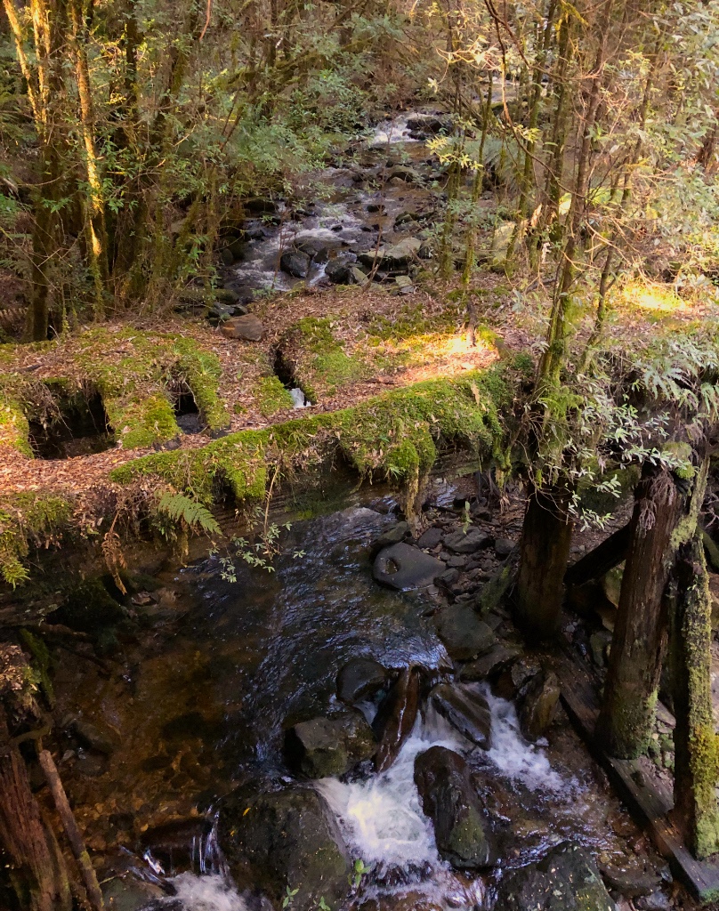
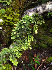
Glimpses of the old tramway are still very evident as you pass between moss and tree-lined cuttings blasted through rock and many timber sleepers exposed, some with hand made nails still in place. More impressive though are the original bridges that cross the streams and gullies. No longer safe to cross and sectioned off, the bridges are now home to many forms of moss, fungi and lichen with young trees even taking hold in the slowly decaying timbers.
Original bridge of the Northeast Dundas Tramway
Watch your Step
The track remains wet and muddy in places throughout the year and you’ll find yourself navigating across thoughtfully placed rocks and logs to avoid some of the worst spots. Though mostly level, the track requires sensible footwear and not the thongs that we witnessed several people wearing.
Thick rainforest hides much of the view of the Pieman River below, which is amazing considering the valley was heavily felled in the 1890’s. Now autumn, bright yellow and red Myrtle leaves litter the track like confetti among the many large tree ferns and moss covered leatherwood and sassafras trees. It’s for good reason the stunning, unspoilt scenery has made this a very popular walk.
A surprise Reveal
The highlight of the walk, of course, is the waterfall and although you can hear it in the background as you approach, its sudden appearance around a corner still comes as a surprise. Climbing a small observation deck just beyond the narrow suspension bridge and you get your first view of Montezuma Falls. But look upwards and there’s more. Crane your neck even further and the top of the 104-metre fall, Tasmania’s largest single drop, comes into view. It’s a surprising reveal and completely unexpected.
Montezuma Falls
Without a frame of reference it is hard to portray the true size of the cascading fall. You really have to be there to witness it for yourself. To stand back a little further requires a walk across the suspension bridge. It’s not for those with a fear of heights or a platform that sways with every step. It’s a white knuckle crossing and a real test of those brave pants.
A hike to Montezuma Falls is absolutely recommended if you are ever in the area and a must if planning a trip around this spectacular island.
Our last day in Cradle Mountain National Park and despite snow overnight and bitterly cold winds, we were determined to make one last trip to Dove Lake to try and capture a photograph of last night’s snow on the mountains. The weather had other plans.
A Big Disappointment
But first we wanted to visit the close-by Wilderness Gallery located beside the Cradle Mountain Hotel. We had visited the gallery previously many years ago and vividly remember the stunning photographic landscape exhibition. We checked the gallery’s website to make sure it was open during this Easter Monday. Disappointingly we arrived to find it closed. We were later advised staff shortages were responsible. A simple update to their website shouldn’t have been that difficult to do.
Too close to the Edge
Everyone taking the shuttle bus to Dove Lake from the Visitor Centre will be aware that the road isn’t in the best condition. It is also very narrow in places with large trees restricting passage even further. Our driver this morning didn’t help settle any passenger’s discomfort when she described an accident here in 2001 where the road beneath a bus, making space for a passing vehicle, collapsed and fell 33-metres before hitting a tree leaving 4-people dead and 14-injured, some seriously. A subsequent report to the government recommended improvements to the road but were restricted by its World Heritage Management Plan, which stated: “Retain the Cradle Mountain Road from the Visitor Centre to Cradle Valley car park as a narrow, winding tree-lined road to protect the character of the park.” Good to know where public safety priorities stand. In the end there were improvements with some of the gravel road surfaces being sealed and kerbside markers installed. From our experience it still needs more work on the potholes.
Blowing a Hoolie*
We were greeted by a strong gusting wind and rain as soon as we climbed off the bus. The view towards the mountains was little more than an icy grey mist and we chose to wait in the glass fronted viewing shelter in the hope that the weather would improve. It was a while but patches of blue sky occasionally appeared and the vegetation around the lake briefly took on a some colour. Eventually the sun stayed long enough to produce a rainbow across the lake as we attempted to take a photograph between raindrops on the window. Needless to say we didn’t stay much longer.
It’s blowing a hoolie
Knyvet Falls
Wanting to make the best of the day we joined our travel buddies on a short walk from the Ranger Station near Cradle Mountain Lodge. It was a walk we were so glad we took.
Knyvet Falls boardwalk
Descending into Dove Canyon beside Pencil Pine Creek was like stepping into another world – a very green one. Masses of twisted trees were covered in lichen, mosses and old man’s beard. Streams trickled among mounds of moss, fungi and golden leaves fallen from Myrtle trees while in the background the river was tumbling among the granite boulders that remained from the last ice age. It was a magical place.
Vivid greens
Protecting the delicate mosses from footfall was a boardwalk for the entire length of the walk, which snaked around trees, up and down slopes and across streams. There was so much to look at and photograph we were soon being overtaken – tricky on a narrow boardwalk without passing places!
It helped that we were protected from the cold winds and passing showers overhead. We were in no rush to move on and could have happily spent hours wandering around here but there was something else to see a little further along and in the background we could hear it – the rush of falling water.
Knyvet Falls
Named after Knyvet Roberts, an early explorer who, along with three colleagues, completed a 5-day cross country hike to Lake St Clair in 1908. It was a time before maps were available and with no defined track over rough country, mountains and rivers. All four survived their gruelling adventure living on the few supplies they carried and echidna, which they occasionally managed to catch.
Knyvet Falls is a wide but not a particularly long drop but it does make up for it in volume – at least at the time we visited in April. The water here, common to the West Coast, is more the colour of a milk-less tea than the crystal clear water you would expect filtering down from the mountains. It is caused by tannins leaching from the roots of the button grass plant and the peat on which it grows.
Unfortunately the viewing platform is perhaps the worst place to get a good photograph of the falls. Several images published via the Internet show a view from the front-left side of the falls but to reach there requires stepping-off the path and that risks damaging the delicate plant life. The main highlight of this walk, though, for us at least, was the coverage of mosses and lichen that forms on anything stationary long enough for it to get a hold.
Lichens
Time for a little Warmth
There’s nothing better than a hot drink in front of a log fire after a walk in the cold weather. And that’s exactly what we had in mind as we crossed the road and headed for the Cradle Mountain Tavern. We weren’t alone. Two roaring log fires were warming the chills off the hikers with wet clothing draped across the back of chairs.
Mulled wine by the mug was on offer. So too were delicious hot cross buns eased along with a latte and the good company of our travel buddies. It was a great way to relax before catching the shuttle back to camp.
One last cold night before we move on and the promise of warmer, drier weather ahead. Cradle Mountain was everything we hoped it would be. Mixed weather didn’t spoil our visit, instead it emphasised the wild and unpredictable nature of high altitude wilderness.
* The word ‘hoolie’ is believed to come from the Orkney Scots word ‘hoolan’, meaning a strong gale and the Irish word for a noisy party.