Mount Gambier
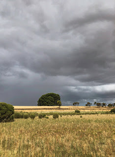
Building upon the slopes of a dormant volcano is perhaps not the first location you would choose when establishing a new city but that is exactly where Mount Gambier in South Australia began. But it is there for one very good reason.
Vital to life in this hot and dry country is fresh water and Mount Gambier has it to excess. Mount Gambier is both a town and the name of the volcano from which it takes its name. Having last erupted approximately 5,000-years ago, the Mount Gambier volcano formed above a ‘hot spot’ in the earth’s crust with magma melting its way up through the limestone bedrock of the region’s Limestone Coast.

Being porous, ground water was able to seep into the volcano’s magma channels resulting in steam driven explosive eruptions, a sight that was witnessed by the local Bungandidj aboriginal mob who named the volcano, Willum-a-weenth, meaning place of fire. The Bungandidj people of post volcanic activity often referred to the volcanoes as their ‘camp ovens’, which may have indicated the ground was still hot but they were fearful of rumbling sounds that they attributed to the ‘moaning bird spirit’ and left the area.
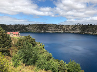
By the time the volcanic activity had ceased an enormous cinder and ash cone with a crater measuring over 1.6KM wide and 192-meters high had formed. But the volcano has one unique feature – the base of the crater sits below the water table resulting in a near permanent supply of fresh, limestone filtered water to a depth of 70-metres and containing approximately 36,000,000,000 litres.
The Blue Lake
The resulting lake, known as Blue Lake, is one of four formed by the volcano but by far the largest and most dramatic. It takes its name from the colour of the water that undergoes a change during the warmer summer months becoming a deep sky-blue but reverting to more of a grey during winter. In reality the water itself does not change but the presence of microscopic calcite crystals react with sunlight to diffract light entering the water, much like a prism, and reflect back to the viewer just the visible shades of blue.
Below the surface large freshwater stromatolites have been growing for tens of thousands of years before being discovered by divers researching the depths of the lake. These ancient life forms, normally found in shallow waters around the planet, are believed to be the originator of most of the oxygen present in the atmosphere of the early Earth.
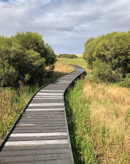
Far above the ground a footpath, and road, runs around the entire rim of the crater and is just as popular with locals exercising as it is for tourists taking in the view. In several places around the top of the crater the ash from the eruptions is clearly visible as are large chunks of solidified magma and limestone. Some rocks that were blasted clear of the crater weigh up to 20-tonnes.
Blue Lake is the primary source of water for the city and the very reason Mount Gambier was chosen as the early settlement. Currently 3,600 million litres of water are extracted each year and over the past 25-years the level of the lake has dropped by only 2-metres though water has been pumped from the lake since 1884. It has been calculated that the entire 36-billion litres of the lake is replaced on a cyclic basis by natural processes every 10-years.
A Sinking feeling
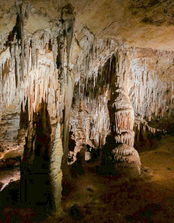
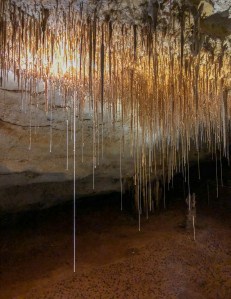
Mount Gambier, the city, is also home to another geologic process that has had a significant impact on the region. The limestone dissolving action of acidic water has produced many caves in the region some of which have collapsed forming large sinkholes – right in the middle of the city! Fortunately these sinkholes have been around longer than the founding of the city and are just two of a known fifty in the region…but how many more are yet to appear?
Both sinkholes became major attractions during Victorian times and, as was popular at the time, the sinkholes were ‘beautified’ with flower gardens. Both are impressive and highly unusual – especially considering their modern day location. This act of beautifying a natural feature of scientific importance would be considered gross vandalism these days and most probably illegal, but how much better is it for it? Would people still be drawn to a hole in the ground in the same numbers as present? I very much doubt it.
Cave Garden
Situated just behind the City Hall, Cave Garden was once the original water source for the first settlers. During periods of rain a waterfall still forms providing a dramatic view as it descends into the remaining cave structure.
During our visit many of the flowers around the rim of the sinkhole were being removed as the spring flowers were dying back so it wasn’t at its best. From photographs that we have seen, autumn appears to be the most colourful time to visit.
A viewing platform overhanging the rim gives a good opportunity to peer down into the depths and each evening a light show projects Aboriginal Dreamtime stories on the wall of the sinkhole.
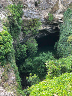
Umpherston Sinkhole
But the most spectacular is the huge Umpherston Sinkhole located opposite the Mount Gambier Visitor Information Centre. This sinkhole was made into a sunken garden by James Umpherston in 1886. A descending pathway and timber steps lead down through concealed viewpoints and among terraced gardens to reach the base where, originally, a small lake gave people the opportunity to view the gardens by row boat from a different angle. The water table has since dropped leaving the base of the sinkhole mostly dry.

Planted with hydrangeas, tree ferns and agapanthus, the walls of the sinkhole, though, are the most impressive being draped with hanging ivy. Sadly much of the grass between the terraces was well trodden despite notices to KEEP OFF THE GRASS.
As we visited the sinkhole was full of people enjoying the warm weather, which made taking a decent photograph tricky. Fortunately there was plenty of greenery to hide people behind.
During the evenings people gather to feed the resident possums that come out of hiding for an easy feed.
A tough climb
18KM south of Mount Gambier and visible from Mount Gambier’s volcanic rim is a second significant volcano named Mount Schank standing 158-metres high from base to rim. This volcano has had far less human intervention with just a very narrow and exposed path running around the rim of the cone. For those steady on their feet there is a weaving path that drops down to the centre of the volcano’s base allowing further exploration.
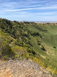
There is, however, one very noticeable work of skilled hands. Leading from just above the parking area to the top of the cone are 1,035 limestone steps. Unusual in their placement, they certainly make the very steep climb up and down the volcano safer and gives good footing to admire the impressive views across the surrounding plains. It is not a walk for the unfit or unsteady, and it is tough going, but the view from the top looking down into the crater is every bit worth the hard slog.
Make sure to take plenty of water especially if you plan to add the drop into the crater part of your experience here.
Where’s the Coffee?
As anyone following our adventure will know, we can often be found exploring the best coffee shops we can find and Mount Gambier has one of the best we have experienced since our trip began in April 2019. The Metro Bakery on Commercial Street is an interestingly quirky place with its Steampunk wall art but it serves an excellent latte and the cakes are an equal to anything you would see in the best French Patisserie. Hot meals, snacks and even a bar is provided for those of a less sugary taste. Very highly recommended!