Port Douglas

60KM north of Cairns and bordering on two UNESCO World Heritage listed sites, Daintree Rainforest and the Great Barrier Reef, is the coastal town of Port Douglas – another town in Queensland established following the discovery of gold in 1877.

What’s in a name… or several?

Named after the former Premier of Queensland, John Douglas, Port Douglas’ development was largely based on the mining industry with timber cutting playing a part along the Daintree River. Unusually Port Douglas wasn’t the port’s first name, nor the second. It was previously known as Terrigal, Island Point, Port Owen and Salisbury.

Driven by tourism

These days Port Douglas is largely driven by tourism thanks to its location close to the Daintree Rainforest, 4-Mile Beach, Hartley’s Crocodile Adventures, Cape Tribulation and fast boat access to the inner and outer regions of the Great Barrier Reef. But it wasn’t until the 1980’s that tourism took-off following construction of the Sheraton Mirage Port Douglas Resort. Now the Mirage is just one of the many hotels and resorts that Port Douglas has to offer as well as holiday apartments, caravan sites and private accommodation.

Port Douglas Harbour

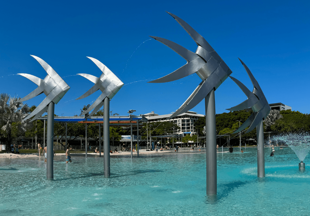
While staying in Cairns this week we decided to spend Sunday in Port Douglas, specifically to visit the Sunday Market located on the foreshore. It was our third visit to the Port in 18-years and likely not the last.

Port Douglas Sunday Market

The market is open from 8am to 1.30pm at ANZAC Park and features locally made products including jewellery, clothing, crafts and artwork as well as food and the all important coffee and pastry stalls.

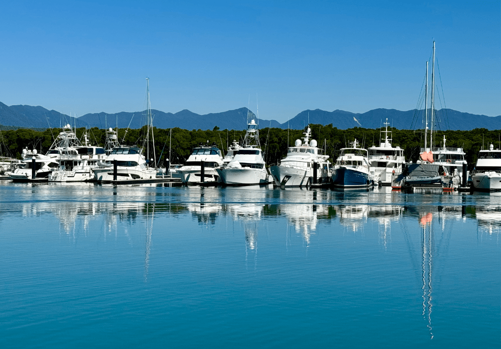
The market backs onto the beach and one of the classic Port Douglas photo spots – the Sugar Wharf.

The Sugar Wharf

Saint Mary’s by the sea

Another popular photography location and adjacent to the market is the cute timber clad Saint Mary’s by the sea – a non-denominational chapel. Initially constructed in the 1880’s as Saint Mary’s Roman Catholic church, it was destroyed by the cyclone of 1911 and rebuilt between 1913 and 1914. Saint Mary’s is now a popular wedding chapel available for hire as is the Sugar Wharf for wedding receptions.

Saint Mary’s by the sea

Since our last visit the once immaculate chapel is now clearly in need of a fresh coat of paint. However, a peek inside will impress with a lofty vaulted ceiling and a window directly behind the alter providing a stunning view over Trinity Bay towards the Daintree Rainforest in the distance.

Cyclone Yasi

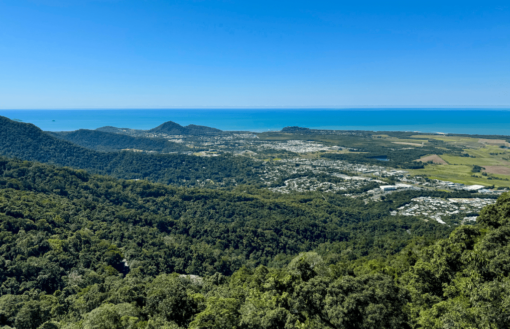
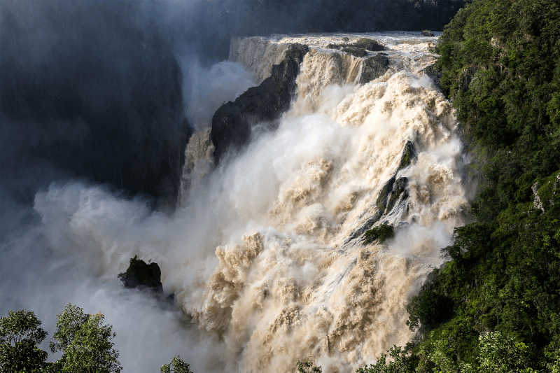
No different to all coastal towns in Far North Queensland, Port Douglas is not immune to the seasonal cyclones. To date the Cairns and Port Douglas region has felt the impact of 53-cyclones since 1876 with the worst for Port Douglas being on March 16th 1911 when only 7 of the 57-properties remained standing with two lives lost. More recently, in December 2023, cyclone Yasi made landfall. It wasn’t the wind that devastated the area but the weather events that followed with more than 3.2-metres of rain falling in less than a week – that’s more than 2-year’s average rainfall. Over 100-land slips and rockfalls caused widespread damage with severe flooding, houses destroyed and some communities isolated as a result of collapsing coastal roads. Almost a year later and road repairs are still ongoing with many sections of the Cairns to Port Douglas road affected. And up in the mountains the scars of landslips will remain visible for a great many years to come.

Balancing Stones

Something we first spotted along the coast of the South Island of New Zealand is the art of stone balancing. Seemingly something of a bit of a hobby for our New Zealand cousins, stacking round stones has spread across the ditch and nowhere better displayed than on the rocks beside the Cairns to Port Douglas road.

Balancing Stones

There’s parking available for a few cars to pullover and explore the many stacks that have been built. Maybe even have a go yourself.

The Crocodile Hunter

In 2006 Port Douglas hit the international news when Steve Irwin, the ‘Crocodile Hunter’, was tragically killed by a stingray, ironically, during filming of the documentary ‘The Ocean’s Deadliest’ on nearby Batt Reef. Steve’s death came as a shock and was so unexpected for someone who had spent most of his life working with some of the most deadly creatures on this planet. His wildlife warrior legacy continues with his family – Terri, Bindi and especially his son, Robert, who has stepped into Steve’s shoes with the same infectious enthusiasm as his father.

Australia Zoo, based in Beerwah, Southeast Queensland, is dedicated to Steve’s quest to better understand and protect wildlife wherever it exists anywhere in the world.

Cairns – a City in a garden

Often described as a city in a garden, it’s easy to see why – lush, tropical and colourful.

For over a century following Captain Cook’s 1770 voyage, Cairns was simply known as Trinity Bay. In 1876 following the discovery of gold to the west of the tablelands, a port was constructed as an export facility and the area surrounding the new port was named Cairns in honour of Sir William Cairns the then Governor of Queensland.

Cairns is now a large coastal town supporting a diverse agricultural region as well as a major international tourism centre with lots to offer the visitor. Wether it be its close proximity to the Great Barrier Reef and its many adventure tours from the harbour, its position sat between the Coral Sea and the dominating mountains or its ancient Daintree Rainforest, there is something here for everyone. For travellers it even has its own international airport just minutes from the city centre.

Mud, glorious mud

Shaded by giant figs and native almond trees is the Esplanade, a winding pathway along the coastal front providing a relaxing walk sheltered from the sun. A large pool known as the Lagoon takes centre stage, which is hugely popular with locals and visitors alike, surrounded by lawns to sit and enjoy a picnic or just catch a few rays.

The Cairns Lagoon

Cafes and restaurants line the inner esplanade providing everything from fresh seafood to delicious gelato. On the coastal side, when the tide is out, unfortunately, is a very large expanse of mud – not the most picturesque of views. That said, this is crocodile country so keeping away from the sea isn’t such a bad idea. And with the large pool and children’s playground there’s plenty to keep the little, and not so little, ones amused.

Cairn’s muddy Waterfront

Esplanade Closed

The evening before we arrived in Cairns we heard reports that a helicopter had crashed into a hotel in the early hours of the morning. It didn’t seem to make sense. Why would a helicopter be flying so low, so fast – according to witnesses, and at night. Suspicion was confirmed the following day. The helicopter had been taken from Cairn’s airport and crashed into the Double Tree Hilton Hotel on the Esplanade shortly after. An elderly couple, in the room immediately below the crash, had been taken to hospital and were being treated for shock. The crash had completely collapsed the windows of their hotel room. Later in the day it was confirmed that the New Zealand helicopter pilot working for Nautilus Aviation in Cairns, had been out celebrating his promotion with colleagues and, afterwards at around 1.50AM, had accessed the General Aviation area of the airport, entered the company’s office, took the keys to the helicopter and decided to go for a ride. The short flight ended in a fiery crash in which he was killed. It was an unauthorised flight and he was not licensed to fly in Australia.

We saw the crash site as we walked along the Esplanade a couple of days later after the area had been reopened following investigations by the Australian Transport Safety Bureau.

Palm Cove

On a lighter note and just 30-minutes north of Cairns is the popular beachside resort of Palm Cove featuring a glorious beach backed by countless coconut palms and 500-year old paperbark trees. Being so picturesque it is no surprise that Palm Cove is one of Australia’s most popular wedding destinations and also the nation’s Spa capital.

Palm Cove beach

Palm Cove is also well provided with eateries including several fine dining restaurants with views out to Double Island. We can certainly vouch for Vivo after a superb meal we had there on our day visit from Cairns. Just as well provided are the options for accommodation ranging from boutique hotels to caravan and camping sites.

Vivo Restaurant – Palm Cove

Parking during peak times may be a challenge so arriving early is recommended. Even during the peak holiday period when we visited the beach was almost deserted… or maybe everyone was still trying to find a parking space?

Coconuts

Big 4 Ingenia Holidays Cairns Coconut Resort has been our home while in Cairns and we can highly recommend it. Known simply as ‘Coconuts’ the resort is fully featured with lush tropical planting (and yes that includes coconut palms) caravan, camper van, trailer and tent sites as well as many villas, two pools, children’s playgrounds, tennis, volleyball and basketball courts, outdoor cinema, a spa, cafe, bar… the list goes on. It is in a great location too just off the highway and only 7KM from the centre of town. Transport is just as good. Rather than take the car it’s easier, and much cheaper, to take a bus to the city. Just introduced in Queensland, as part of the cost of living relief, is the 50-cent fare on buses and trains. And with the bus stop just a few minutes walk from Coconuts you would be nuts to drive yourself.

Tomorrow we reach the furthest point north in our trip to Far North Queensland – Port Douglas.

Skyrail Rainforest Cableway

We’ve finely reached our most northerly destination on this trip – Cairns in Far North Queensland (FNQ). And where better to get an overview of the city than from up above.

Up in the Air

A great place to get an overview of Cairns is to climb onboard Skyrail’s 7.5km Rainforest Cableway – a cable car with a dramatic view and once the longest cableway in the world. Located just 15-mins north of Cairns at Smithfield within the UNESCO World Heritage Listed Barron Gorge National Park.

Cairns from above

Free parking is provided directly in front of the Smithfield terminal and serves both the Skyrail and Kuranda Scenic Railway. For those booking Skyrail to Kuranda in one direction and the train in the other, a courtesy bus, stopping in front of the Skyrail terminal, takes guests to and from Freshwater Train Station. Alternatively the train can be caught in Cairns directly.

Bookings Essential

It should be noted that during peak periods, this currently being one of them, it is essential to pre-book tickets. Each car seats six people and you may be required to share with others. Look on it as being an opportunity to meet like minded people and share travel adventures – we did.

Boarding is a little slow at this time of year but we were soon setting-off on the first section of the cableway. The steep 10-minute ride climbs to the 545-metre summit of Red Peak with expansive views over the city and beyond before descending a little over the rainforest to Red Peak Station. A change of car is required for the next span, by far the longest, but the opportunity to take a short break to explore along the signed boardwalk at Red Peak is recommended. Time permitting, there is still the option to take-in the walk on the way back if returning by Skyrail.

Riding over the Rainforest

The cableway then traverses the spectacular tropical rainforest for another 20-minutes giving the opportunity, if you’re brave enough, to look down below at the diversity of trees, shrubs and vines and potentially the Ulysses butterfly as its iridescent blue wings standout against the backdrop of tree foliage. As an extra paid option the Skyrail Diamond car is available with a transparent floor if the standard car is not scary enough for you or the little ones.

Barron Falls

The next stop is Barron Falls, a huge rocky ravine where the Barron River falls over granite rock as it descends from high in the Atherton Tablelands towards Cairns.

Barron Falls in Winter

In the ‘Dry’ season (April to October) the falls still flow, and more so following rain, but during the ‘Wet’ (November to March) you can witness the falls at their best where the torrential tropical downpours create a boiling, seething maelstrom of water and spray as it crashes down into the gorge. A good viewpoint is the Edge Lookout opened in 2019, which, incidentally, has a glass floor to make the drop of 160-metres to the gorge all the more enjoyable! It’s highly recommended to stop here and take the short walk to the cantilevered lookout before rejoining the next available car for the 15-minute ride to the final stop at Kuranda Station.

Barron Falls in Summer. Credit: Tourism Tropical North Queensland

Kuranda

Originally settled by the Djabugay indigenous people around 10,000-years ago and whose relatives continue to this day, Kuranda was later settled by Europeans in the mid 1880’s taking up farming in the area and producing timber, dairy cattle and eventually coffee. During the ‘Flower Power’ and anti-Vietnam War period of the mid-1960’s, hippie communes developed seeking a simple, self-supporting, laid-back lifestyle. Today the hippie influence is still very much in evidence as is the drifting scent of incense, especially in the ‘Kuranda Original Rainforest Markets’. Sadly the market has lost its once popular craft and food scene and looks increasingly neglected as new stores open on the main streets selling cheap tourist junk. To us, and since our last visit more than a few years ago, Kuranda has lost its edge. It’s not cheap to get here and apart from the picturesque Kuranda Scenic Railway Station and the Butterfly Sanctuary the journey here is now the highlight and no longer the destination.

Kuranda by Rail

For those not having the stomach for a swinging cable car, there is an alternative option. The Kuranda Scenic Railway can be caught in Cairns or Freshwater Station and provides views of the surrounding landscape on its winding climb up to Kuranda Station with a brief stop at Barron Falls to get the best photo opportunity.

The train can also be combined, for those choosing a little more variety, to go up to Kuranda by train and return on the cable car or vice-versa. We have done both and the two are equally recommended.

Construction of the 37KM long railway started in 1887 and reached Kuranda in 1891. The railway required 15-tunnels, which were dug by hand and 37-bridges. It wasn’t until 1936 that the railway was opened to tourism.

Kuranda Scenic Railway Station

How do you build in a protected Rainforest?

Think for just a minute about all the indigenous people of the region, save the trees campaigners, the political activists and those that genuinely want to protect natural forests for future generations, and you have to wonder how Skyrail got permission to build a 7.5km cable car through a rainforest, a World Heritage listed one at that. Well, certainly there were protests both from locals, environmentalists and the indigenous people. It was regularly in the press and on TV and in radio reports. It gained worldwide attention not only for the proposed development within a pristine and ancient environment but also for the precedent that it would set for other developments around the world in highly sensitive environments. Should it get approval the proposal would be the first ever commercial development in a World Heritage listed area.

And, remarkably, it did! It would give people the opportunity to see and experience this ancient rainforest without any erosion causing foot traffic. After much debate and negotiations a compromise by the developer was reached requiring construction of the cableway to be made from the air, the concrete, steel gantries and the construction teams – all delivered by helicopter. And so it was, Skyrail opened to the public in August 1995. Today Skyrail is so busy during the peak season that, as we have mentioned, pre-booking is essential.

Booking options and further details available on Skyrail’s website

Bring on the Silo Art

Being a major grain supplier to the world means Western Australia, South Australia, Victoria, New South Wales and Queensland are littered with giant grain silos. Highly visible from the road and railways and a feature of the Wheatbelt, these bland concrete structures are in need of a makeover. Time then to get the paints out.

The Silo Art Trail

After 3-months in Tasmania we’re back on the Mainland and on the trail of Silo Art. We saw our first painted grain silo back in 2017 on an edition of Australia’s TV show MasterChef. The show’s contestants faced the challenge of cooking outdoors for invited diners beneath a giant mural painted on Brim’s grain silo in country Victoria.

It started in the West

What began as a series of painted silos at CBH Northam Grain Terminal in Western Australia in 2015 soon started a trend attracting Australian and international artists to create these immense works of art across the country. And it wasn’t long before communities and regional councils realised the potential of attracting tourists to their small towns putting them on the map as a destination rather than a town to pass through on the way to somewhere else. And there began the Silo Art Trail.

Back on the Trail

During our Big Lap of Australia in 2019 we stopped at many of Western Australia’s Silo Art locations as we headed south and again after crossing the Nullarbor into South Australia. A family emergency overseas meant we had to skip the many silos of Victoria but now, heading back from Tasmania to our home in Queensland has given us the opportunity to visit many of Victoria’s silos, two in New South Wales and one in Queensland.

Silo Art – Victoria

Horsham – Although not the first silo to be painted in Victoria, Horsham Silo was the first on our trail. Painted by artist Sam Bates (aka ‘Smug’) in May 2022, it depicts the western Victorian aboriginal man, Yanggendyinanyuk, who was one of a team of 13 indigenous cricket players who formed the first Australian cricket team to tour England.

Horsham Silo – Victoria

To the left of the silo, and partly obscured by a steel fence, is another highly detailed mural by Sam Bates, this time of a Red-Tailed Black Cockatoo. Many people were unaware of the second mural and so Sam returned to paint the wall in front of the silo in May 2023 to link both murals together while giving the visitor a rare close-up view of the stunning detail of the artwork.

Red-tailed Black Cockatoo – Horsham

Murtoa – Better known for the incredible Stick Shed, Murtoa has also received the painted silo treatment by Sam Bates. Situated in the town adjacent to the railway line and a series of rusting silos, Sam’s artwork has to compete with the graffiti decorated rail cars. The painting highlights 29 species of bird that can be found in the Mallee region and a radiant bird said to represent the one in 30 Australians who experience a Bipolar condition.

Murtoa Silo by artist Sam Bates – aka ‘Smug’

Rupanyup – Next stop on the trail travelling northwards is the twin silos at Rupanyup. Here a convenient visitor shelter has been constructed opposite the silos detailing the many crops grown in the region.

Rupanyup Silo – Victoria

Created by Russian artist Julia Volchkova in 2017, Rupanyup’s twin silo artwork features local residents and sports members, Ebony Baker and Jordan Weidemann.

Sheep Hills One of the more remotely located but accessible silos is the GrainCorp Silos at Sheep Hills. Painted by mural artist Matt Adnate in 2016, it features Wergaia Elder, Uncle Ron Marks and Wotobaluk Elder, Auntie Regina Hood, looking toward the two young indigenous children, Savanah Marks and Curtly McDonald.

Sheep Hills Silo – Victoria

What sets these silos apart are the vibrant colours Matt chose, the detail in the children’s faces and the deep violet of the sunset blending into the deep-black star-trail sky.

Brim – Completed in January 2016 by Australian mural artist Guido van Helten. The GrainCorp silo in the township of Brim was the first silo to be painted in Victoria and only the second to be painted in Australia. It marked the beginning of the silo art trail of Victoria.

The murals depict four hardy, weather-beaten farmers who share the typical resilience needed to farm in the Wimmera Mallee region.

Brim Silo – Victoria

Guido, a talented mural artist, had been looking for a silo to paint and, working with the help of Juddy Roller Art Management, the owners GrainCorp and the Brim Active Community Group, Guido got the go ahead to create a mural on Brim’s silo. But the weather made the task far from easy with extreme heat, strong winds, a dust storm and lightning. Guido often took a break during the afternoons to escape the worst of the heat before returning to continue during the cooler evenings.

Rosebery Silo – Victoria

Rosebery – Created by Melbourne artist ‘Kaff-eine’ and completed in 2017, the Rosebery Silos are said to depict the region’s past, present and future. The left silo shows the future with the stylishly dressed young female sheep farmer wearing turned-down cowgirl boots, jeans and cotton work shirt. By contrast the right silo displays the current and the past with a contemporary horseman dressed in an Akubra hat, Bog boots and oilskin vest.

Lascelles – Another of the monochromatic style murals, this time in the settlement of Lascelles 26KM northeast of Hopetoun. Painted by Melbourne-based artist, Rone and completed in mid-2017. Deliberately using muted colours similar to the existing concrete so as not to distract from the environment.

Local farming couple, Geoff and Merrilyn Horman were chosen as Rone’s subjects for their family’s four generations as local farmers in Lascelles. Pictured below is just one of the two images.

Lascelles Silo – Victoria

For photographers, access to the site is difficult due to private land and the adjacent railway.

Patchewollock – Another highly detailed mural featuring local character Nick ‘Noodle’ Hulland. Painted by Brisbane artist, Fontana Magee in 2016 who had spent time in the local pub looking for a suitable subject. According to Magee, Noodle was a rugged, no-nonsense and lanky character ideally suited to the narrow 35-metre twin silos. With his squinting gaze and sun-bleached hair, Noodle was a reflection of the harsh and challenging environment of the Wimmera Mallee.

Patchewollock – Victoria

Silo Art – New South Wales

Not to be outdone New South Wales has got in on the silo painting act too and has begun commissioning artists to paint both grain silos and water towers to entice tourists and passing trade in an effort to boost the local economies.

Weethalle – Artist ‘Heesco’ completed painting the silo in July 2017 as a tribute to the agricultural heritage of the small town of Weethalle and the surrounding communities of Bland Shire.

Weethalle Silo – New South Wales

Depicting a typical farming community, Heesco’s image displays the annual task of shearing sheep, a farmer checking the grain readiness for harvest and, curiously, a small flock of sheep standing high on a balcony looking out and enjoying the view.

A dedicated car park with ample space for caravans has been provided to encourage passers-by to stop for a while.

Hay – Like many small country towns in Australia the First and Second World Wars took their toll on the young who took up arms to protect the nation and join the raging wars in Europe and the Pacific. In recognition and memory of those brave soldiers and nurses from the town of Hay in New South Wales, artist Matt Adnate was commissioned to paint five of the veterans from among the hundreds who answered the call. Those selected were Private William ‘George’ Cannon, Corporal Cliff Farlow, Private Norman Flack, Australian Army nurse, Lieutenant Lorna Margaret Whyte and indigenous soldier Private Victor George Murray. Display boards at the site tell the unique story of each of the individuals.

Hay Water Towers – New South Wales

Although water towers and not silos, the towers form part of the Australian Silo Art Trail.

Silo Art – Queensland

Yelarbon – Closer to home and the last silo on our homeward bound trip. Another of GrainCorp’s silos and one of the largest groups of painted silos. Painted in two stages between 2018 and 2020 by artists Jordache Castillejos and Jordon Bruce from the artist collective, Brightsiders along with Steve Falco of ProcreatiV.

Yelarbon Silo – Queensland

The mural is titled ‘ When the rain comes’ and depicts a young child sailing a paper boat as it crosses the nearby Yelarbon Lagoon and traverses the six smaller silos. The boat is said to have been made from old newspaper cuttings found in the town’s historic jail and symbolises the history of the region.

There’s more to come

There are many, many more painted silos across Australia and the number is set to continue in the years to come. To date we have visited just a small collection of what is surely the world’s largest outdoor gallery.

Digging Deep in Mount Isa

As you arrive from the southeast, the first sign of Mount Isa is a distant column of smoke. And then closer, crossing the crest of the Barkly Tableland, and you’re confronted with a massive industrial complex sitting in a basin surrounded by hills in every direction. And smoke, lots of it. It is a blot on the landscape but a very necessary one as I’ll explain.

Mount Isa Mines

Mount Isa, you see, is one of the largest and most productive Zinc, Lead, Copper and Silver mines in the world. It is a monster of an operation and that is just what is visible on the surface. Below, reaching down almost 2,000-metres (Australia’s deepest mine), are 400KM of tunnels. Unusual for mineral mines, Mount Isa processes much of its raw materials ready for shipping and export and the very reason for the two towering chimney stacks. Every year up to 300,000-tonnes of 97% pure copper is produced, 436,000-tonnes of Zinc, 156,400-tonnes of Lead and 7,114,000-ounces of Silver.

A long way from everywhere

Being in such a remote location explains why a town is built right next to such an industrial site. The ‘town’ has historically been split into two by the Leichhardt River with the ‘town’ to the west and the ‘mine’ to the east. The miners used to live on the mine side and supporting residents, shop owners and families across the river in town. Over time, with expansion, the two have merged and the larger shops and facilities have graduated closer to the mine. You’ll find the usual well-stocked Woolworths and Coles supermarkets here as well as boutique coffee shops – one in particular being Bambino Espresso on Miles Street, comes highly recommended.

Mount Isa has several attractions for visitors including the City Lookout, Outback at Isa, the Hard Times Mine and The Annual Mount Isa Mines Rodeo – the largest in Australia. Further afield is the well-stocked Lake Moondarra, the Granites and Adeles Grove. The most unusual, however, is the Underground Hospital. Built during WWII by the local miners after their 8-hour shifts had ended and largely by hand. It was constructed following the Japanese bombing raids on Darwin in 1942, which destroyed the Darwin Hospital located adjacent to a military installation. The fear was that Mount Isa could be next with US troops stationed right beside the mine and hospital. Each time the air raid siren was sounded, staff would move patients to the underground hospital. No attack ever took place. The museum has been setup just as it would have been during the war.

Outback Gardens

Outback at Isa

The Outback at Isa and Visitor Centre is certainly worth a visit. It houses the Riversleigh Fossil Centre, Outback Park, Isa Experience and the entry to the Hard Times Mine tour as well as the Outback Cafe, which, by the way, serves excellent scones made onsite with real cream. The Outback Experience tells the history of Mount Isa from the first successful minerals discovery in 1923 by prospector John Campbell Miles to the present day mining operations. A large collection of minerals and fossils are also on display.

The Outback Gardens is an oasis in the middle of a dusty town. Not huge by any means but a 10-minute stroll around the lake with the chance to identify native plants, trees and birds. And, as is very common around this part of Outback Queensland, you’ll see plenty of black kites soaring around looking for prey in and around town.

Now, small as the town is, it is classed as a city and a big one at that. It is actually the second largest city in Australia and one of the largest in the world. Really? By area alone and not by population, Mount Isa local government region covers 43,188 square kilometres and is listed in the Guinness Book of Records. Mount Isa also claims to have the longest city road in the world reaching out 189KM to Camooweal and close to the Northern Territory border.

Lake Moondarra

Just to the north of Mount Isa is the man made Lake Moondorra. Created as a reservoir to provide water for the town and the mine. Right now the water level is low and creating ideal pools for mosquitoes to breed. A warning sign beside the lake warns of one particularly unpleasant disease – Murray Valley Encephalitis, which is spread by the mosquitoes in the area. Being prone to insect bites, I wasn’t about to take any chances.

Lake Moondarra Dam

It’s not the easiest of lakes to access with just a few single track roads leading from the main road. But it’s worth visiting even just to view the water, which is a rare commodity around here. Several picnic areas have been built beside the lake along with a slipway for boats and just a little further along the track leads to a viewpoint and the dam wall.

But perhaps the best part is the colour of the soils and rocks, crumbling cliffs and the beautiful Ghost Gum trees providing a stark contrast to the blue sky and red soil. There’s plenty here too for the nature lover with a wide variety of water birds as well as eagles, kites and kingfishers.

Tomorrow we head further to the West and ever closer to the Northern Territory.