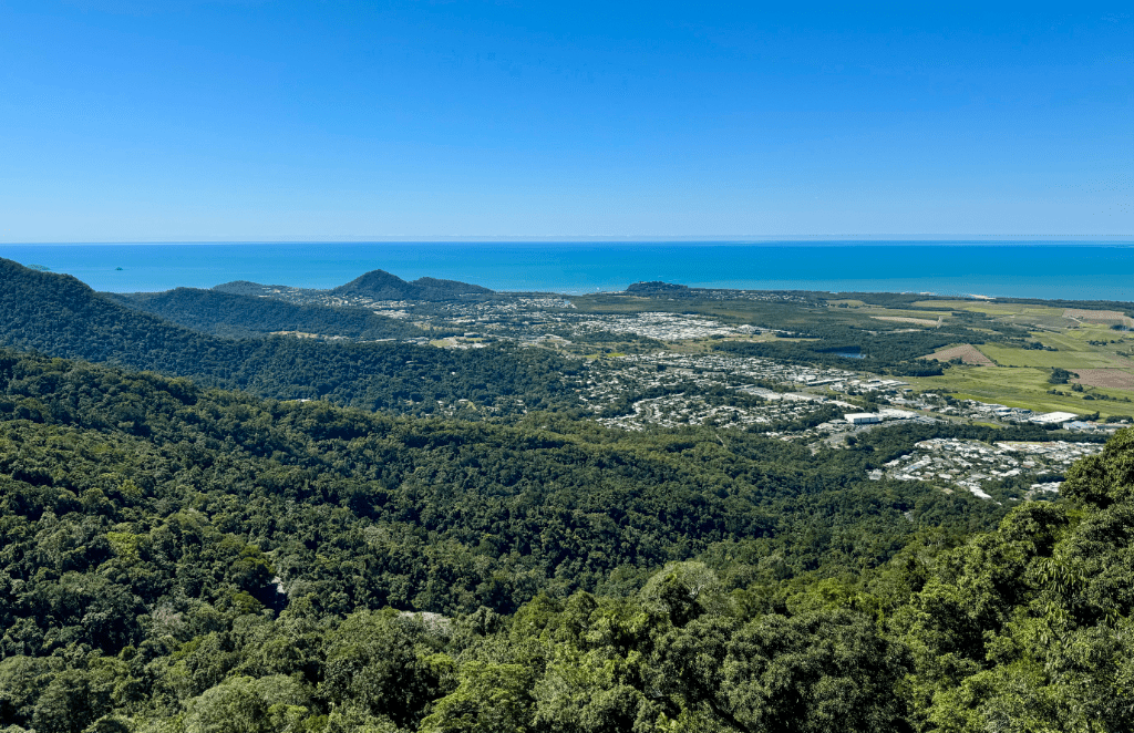
We’ve finely reached our most northerly destination on this trip – Cairns in Far North Queensland (FNQ). And where better to get an overview of the city than from up above.
Up in the Air
A great place to get an overview of Cairns is to climb onboard Skyrail’s 7.5km Rainforest Cableway – a cable car with a dramatic view and once the longest cableway in the world. Located just 15-mins north of Cairns at Smithfield within the UNESCO World Heritage Listed Barron Gorge National Park.
Free parking is provided directly in front of the Smithfield terminal and serves both the Skyrail and Kuranda Scenic Railway. For those booking Skyrail to Kuranda in one direction and the train in the other, a courtesy bus, stopping in front of the Skyrail terminal, takes guests to and from Freshwater Train Station. Alternatively the train can be caught in Cairns directly.
Bookings Essential
It should be noted that during peak periods, this currently being one of them, it is essential to pre-book tickets. Each car seats six people and you may be required to share with others. Look on it as being an opportunity to meet like minded people and share travel adventures – we did.
Boarding is a little slow at this time of year but we were soon setting-off on the first section of the cableway. The steep 10-minute ride climbs to the 545-metre summit of Red Peak with expansive views over the city and beyond before descending a little over the rainforest to Red Peak Station. A change of car is required for the next span, by far the longest, but the opportunity to take a short break to explore along the signed boardwalk at Red Peak is recommended. Time permitting, there is still the option to take-in the walk on the way back if returning by Skyrail.

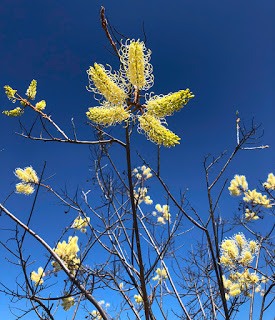
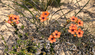
The cableway then traverses the spectacular tropical rainforest for another 20-minutes giving the opportunity, if you’re brave enough, to look down below at the diversity of trees, shrubs and vines and potentially the Ulysses butterfly as its iridescent blue wings standout against the backdrop of tree foliage. As an extra paid option the Skyrail Diamond car is available with a transparent floor if the standard car is not scary enough for you or the little ones.
Barron Falls
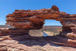
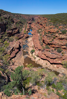
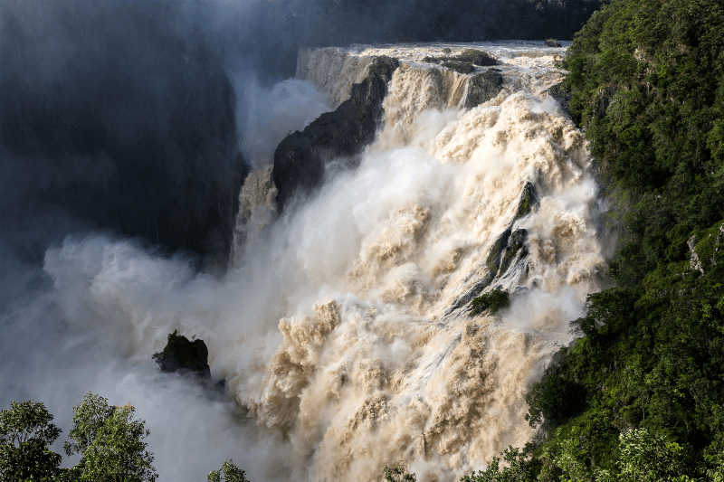
The next stop is Barron Falls, a huge rocky ravine where the Barron River falls over granite rock as it descends from high in the Atherton Tablelands towards Cairns.

In the ‘Dry’ season (April to October) the falls still flow, and more so following rain, but during the ‘Wet’ (November to March) you can witness the falls at their best where the torrential tropical downpours create a boiling, seething maelstrom of water and spray as it crashes down into the gorge. A good viewpoint is the Edge Lookout opened in 2019, which, incidentally, has a glass floor to make the drop of 160-metres to the gorge all the more enjoyable! It’s highly recommended to stop here and take the short walk to the cantilevered lookout before rejoining the next available car for the 15-minute ride to the final stop at Kuranda Station.
Kuranda
Originally settled by the Djabugay indigenous people around 10,000-years ago and whose relatives continue to this day, Kuranda was later settled by Europeans in the mid 1880’s taking up farming in the area and producing timber, dairy cattle and eventually coffee. During the ‘Flower Power’ and anti-Vietnam War period of the mid-1960’s, hippie communes developed seeking a simple, self-supporting, laid-back lifestyle. Today the hippie influence is still very much in evidence as is the drifting scent of incense, especially in the ‘Kuranda Original Rainforest Markets’. Sadly the market has lost its once popular craft and food scene and looks increasingly neglected as new stores open on the main streets selling cheap tourist junk. To us, and since our last visit more than a few years ago, Kuranda has lost its edge. It’s not cheap to get here and apart from the picturesque Kuranda Scenic Railway Station and the Butterfly Sanctuary the journey here is now the highlight and no longer the destination.
Kuranda by Rail
For those not having the stomach for a swinging cable car, there is an alternative option. The Kuranda Scenic Railway can be caught in Cairns or Freshwater Station and provides views of the surrounding landscape on its winding climb up to Kuranda Station with a brief stop at Barron Falls to get the best photo opportunity.
The train can also be combined, for those choosing a little more variety, to go up to Kuranda by train and return on the cable car or vice-versa. We have done both and the two are equally recommended.
Construction of the 37KM long railway started in 1887 and reached Kuranda in 1891. The railway required 15-tunnels, which were dug by hand and 37-bridges. It wasn’t until 1936 that the railway was opened to tourism.

How do you build in a protected Rainforest?
Think for just a minute about all the indigenous people of the region, save the trees campaigners, the political activists and those that genuinely want to protect natural forests for future generations, and you have to wonder how Skyrail got permission to build a 7.5km cable car through a rainforest, a World Heritage listed one at that. Well, certainly there were protests both from locals, environmentalists and the indigenous people. It was regularly in the press and on TV and in radio reports. It gained worldwide attention not only for the proposed development within a pristine and ancient environment but also for the precedent that it would set for other developments around the world in highly sensitive environments. Should it get approval the proposal would be the first ever commercial development in a World Heritage listed area.
And, remarkably, it did! It would give people the opportunity to see and experience this ancient rainforest without any erosion causing foot traffic. After much debate and negotiations a compromise by the developer was reached requiring construction of the cableway to be made from the air, the concrete, steel gantries and the construction teams – all delivered by helicopter. And so it was, Skyrail opened to the public in August 1995. Today Skyrail is so busy during the peak season that, as we have mentioned, pre-booking is essential.
Booking options and further details available on Skyrail’s website