The Tarkine

The greatest expanse of cool temperate rainforest in Australia and the second largest in the world, the Tarkine is a massive wilderness region covering much of the northwest of Tasmania.

Wet and Wild

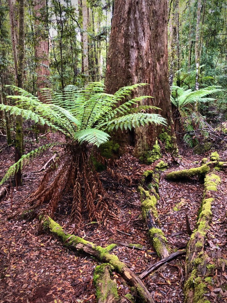
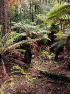
Walking through the rainforest on a damp, showery day is like walking back in time through some mythical ancient forest. And it is with good reason, the Tarkine is a rare remnant of Gondwana, a true and ancient wilderness. It is a land of tree ferns, lichens, mosses, fungi, rare and ancient trees and abundant wildlife including the endangered Tasmanian Devil.

Tarkine Tree Ferns

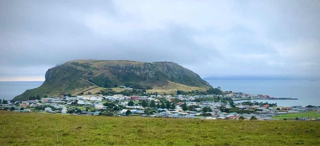
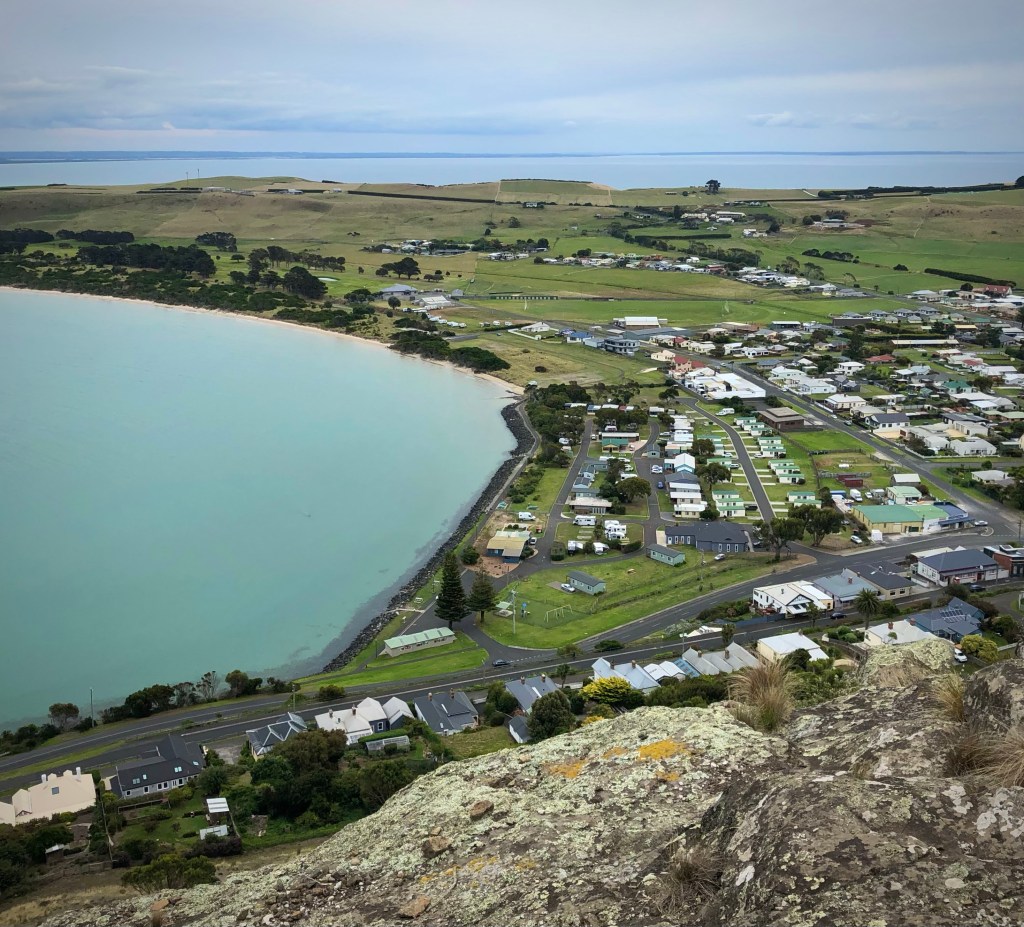
Our visit followed the Tarkine Drive, which takes a circular route through the northwest of the region. Largely black-top ‘C’ grade roads but giving way to gravel tracks to visit many of the highlights. All are passable in sturdy two and four-wheel drive vehicles but there are numerous potholes to navigate.

Trowutta Arch State Reserve

Our first stop was at Trowutta Arch State Reserve and what an amazing walk this was with an unexpected and startling view of the arch. The relatively* easy 30-minute return walk takes you among giant Myrtle Beech trees as well as Leatherwood, Sassafras and Celery-topped pine trees, while in the undergrowth tree ferns, native laurel, brackens, fungi, bright green mosses and algae create a dense forest floor.

Every now and then we spotted what appeared to be white leaves laying on the forest floor and were puzzled where they came from. We later discovered, thanks to a very knowledgeable Park Ranger, that they were flower petals from the famous Leatherwood tree. And it is a tree full of surprises. Very slow growing and only 10-20 metres tall, the Leatherwood tree doesn’t flower until it is at least 70-years old and doesn’t reach it’s peak until 120-200 years of age. Leatherwood is the most common form of honey in Tasmania and accounting for nearly 75% of production. It has a strong and intense floral taste and is easily recognisable among other native honeys. Not surprisingly the Tarkine is one of the major regions beehives are placed during the flowering season between spring and summer. We were lucky to still find Leatherwoods flowering in early autumn.

Giant Myrtle Beech tree

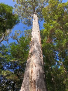
It’s impossible to walk past one of the Myrtle Beech trees without straining your neck and gazing upwards to the crown. They are absolutely straight and void of limbs until reaching the canopy tens of metres above the forest floor. It’s easy to see why loggers were keen to exploit these ancient trees. Thankfully now we are more concerned about the environment and majestic trees such as these are left to grow old gracefully. However, that may not always be the case.

A valuable resource

Unbelievably the Tarkine is not adequately protected with the Tasmanian government seeing this region as a resource to be exploited for timber production and mining. That is despite expert recommendations, commissioned by the government, that it should be protected from any further development. The only way to guarantee this wilderness is preserved for future generations, and for the sake of the wildlife that live there, is to get the whole area under World Heritage listing status. This is a growing, and angry, voice campaigning to protect the Tarkine. Let us hope they succeed.

Trowutta Arch

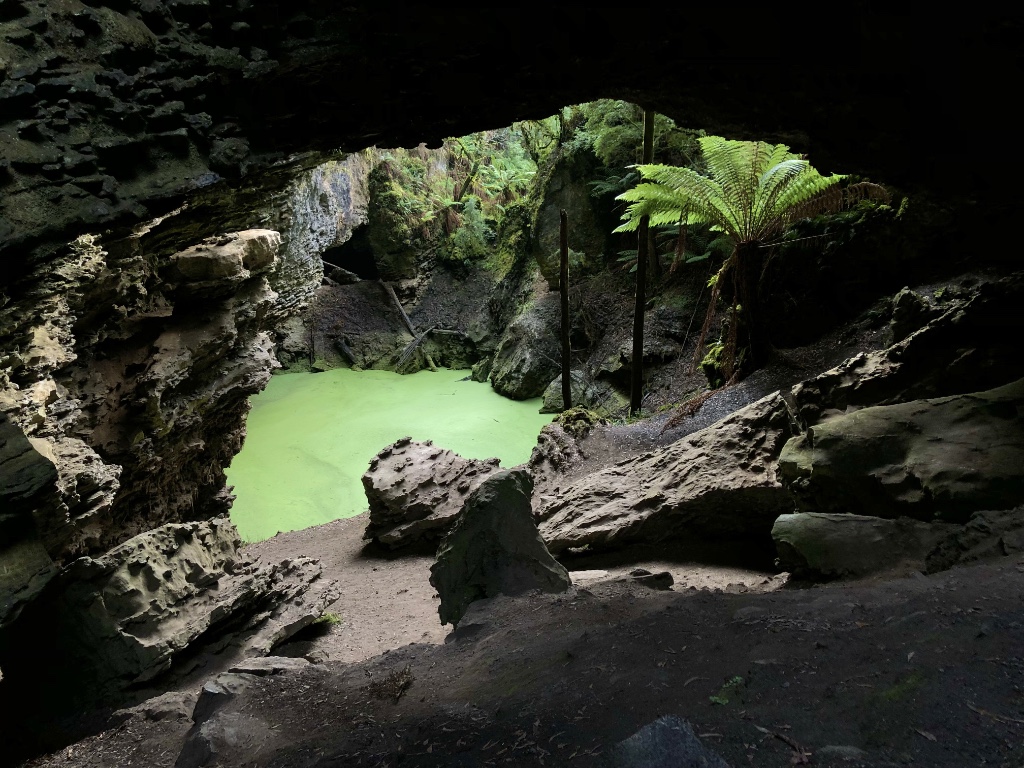
No assuming you haven’t tripped over one of the many tree roots or falling backwards trying to see the top of the Myrtle trees, you will soon, and suddenly, come across a dark, gloomy hole in a cliff face. But right in the middle is a large, luminous green soup of algae surrounded by fallen rocks and tree ferns. It is spectacular, otherworldly even. I try not to look at the photos in guide books – it spoils the surprise, but I could not even begin to imagine this scene. It has been the highlight of our trip to Tasmania… so far.

Morons

Sadly there are those who enjoy such beautiful scenery as this that they feel a desperate urge to deface it with graffiti or scrape their name into the rock. Here it is more evident than any landmark we have seen in all our travels around Australia. Why do such mindless morons do this? Not only is this action illegal, no one but themselves are the slightest bit interested in seeing someone else’s name. Maybe they should remember that they can easily be traced – they gave their details when buying a Parks Pass after all – duh! … assuming they bought one.

Watch out – a Sinkhole!

Much of the region lays on top of a limestone plateau from aeons past when the Tarkine was underwater. Common to many areas around the south of Australia, acidic erosion creates underground caverns and often these collapse over thousands of years to form sinkholes. The Tarkine is not a immune to this form of erosion and many sinkholes have formed. Some are just shallow depressions but several have filled with water supporting a wide range of aquatic life. One such sinkhole sits right beside the road between Rapid River and the Milkshake Hills. Drive to fast and you’ll miss it. It’s well worth stopping to take a look but don’t step too close to the water – the ground is very soft.

Julius River

From the car park there are two walks, the shorter being just a 20-minute circular route beside the Julius River. This path begins on an excellent raised walkway with viewing platforms as you follow the river before dropping to a bush walk. Here you may see Platypus if you’re lucky.

Coral Fungi – Clavulinopsis sulcata

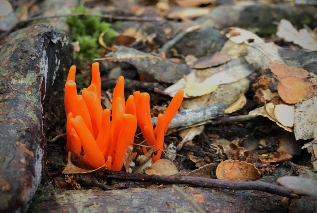
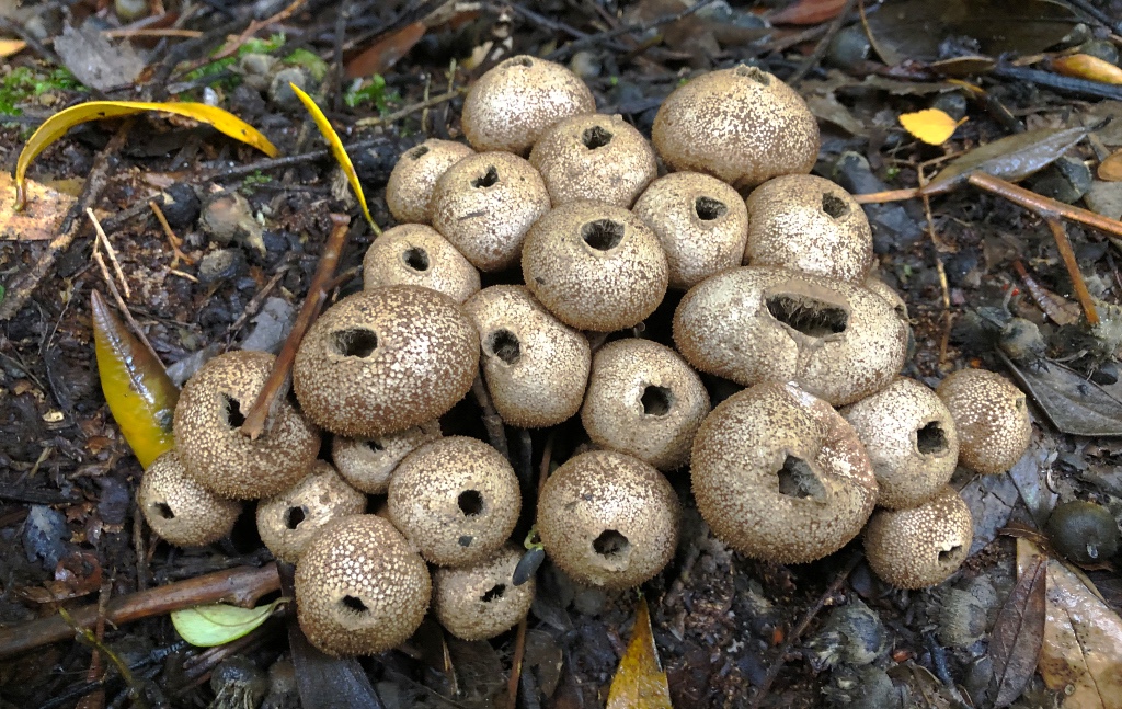
The trees along the walk are hanging with old man’s beard and there are a multitude of algae and parasitic ferns thriving on decaying branches. Also common during the autumn are a wide range of fungi, many brightly coloured and standing out among the fallen leaves and twigs and others such as puff balls arranged in small piles.

Puff balls – Lycoperdon pyriforme

Further along the walk the ascent becomes steep and the parks Service have built a series of very sturdy but narrow steps. These aren’t for those unsteady on their feet or those with a fear of heights. Beware, there are no handrails on most of the steps on this walk. There were plans to add handrails but apparently the parks service had reached the limit of their budget.

At this point the track becomes harder to follow but if you look carefully you’re see some red markers to the left on a tree and subsequent white-topped posts beside several small depressions will guide you to an old downhill track to the car park. But not before one final series of exposed downward steps, which some may find challenging without a handrail.

Sumac Lookout

Our final stop in the Tarkine was at Sumac Lookout. You can’t miss it – there’s a very large ground level sign carved-out with a chainsaw. A small parking area leads to a short stroll to the lookout point high above the Arthur River and an amazing view it offers in all but heavy rain. We were lucky the showers had eased and the sun was trying to break through.

Arthur River from Sumac Lookout

We had thoroughly enjoyed the day exploring this beautiful unspoilt region of northwest Tasmania, exceeding everything we had expected by a long margin. It had been a cold, blustery day but the weather just added to the atmosphere. This was the Tasmania we had really hoped to see and we were amply rewarded.

* A large part of the walk is among tree roots, which are a trip hazard as well as slippery when wet.

At the Edge of the World

Still batted by strong winds, we’ve moved further west, as far west as we can go in Tasmania – we’ve reached the Edge of the World!

It’s Wild

The northwest of Tasmania becomes ever more remote the further you head west until you reach the Indian Ocean. It can be a wild place with strong winds and heavy rain sweeping across the ocean until it hits land. Suitable for cattle farming and little else as witnessed by the enormous number of dairy cattle dotted across the rolling fields.

Edge of the World

This is no place for townies. It is a place for the lover of the outdoors, the wet weather and muddy boot brigade, the adventurous who wish to explore the wilder places of this world. It’s where the roaring forties makes land. This really is the Edge of the World – literally. It says so on the map.

Looks can be deceiving

Located on Gardiner’s point beside Arthur River, the driftwood strewn beach is testament to the wild, unpredictable weather in the northwest. From this point looking out west the next landfall is Argentina.

Looks can be deceiving, though. We were fortunate on our visit, the sun occasionally appeared between showers and the 45kmh gusts were a mere breeze in comparison to the dark skies and gales of the Indian Ocean at its worst.

A bronze plaque stands with its back to the sea cast with the following inscription by the late Brian Inder:

THE EDGE OF THE WORLD

North West Coast Tasmania

I cast my pebble onto the shore of Eternity.
To be washed by the Ocean of Time.
It has shape, form and substance.
It is me.
One day I will be no more.
But my pebble will remain here.
On the shore of Eternity.
Mute witness for the aeons.
That today I came and stood.
At the edge of the world.

Brian Inder

Brian and his wife Laura created Tasmazia, one of the world’s largest maze complexes – and the Village of Lower Crackpot – at Promised Land in the 1980s.

Dip and the Big Tree

We’ve been experiencing some of Tasmania’s wild and windy weather over the past few days but that was not going to stop us exploring the northwest of Tasmania and all it has to offer those adventurous enough to brave the inclement weather.

Totally Wild

Today we headed 56km inland to see a big tree, actually The Big Tree, and Dip Falls both situated within the stunning Dip River Forest Reserve and the 450,000 hectares cool temperate rainforest known as the Tarkine. It’s a remote place and visually spectacular with large tree ferns and mosses lining the narrow road. It’s not hard to imagine dinosaurs still roaming around.

Upper Dip Falls

Sadly the signboard at Dip Falls had been vandalised by some idiot who must have thought it helpful to melt a hole in the perspex protective screen and fill it with gravel. Fortunately it’s very easy to see where the path leads and there are two choices. The easiest route to the falls crosses the road bridge where you can see the river disappear below, and a short level stroll to an observation platform overlooking the upper falls.

Lower Dip Falls

For the more adventurous, and sure footed, you can take the route into the forest direct from the car park and climb down the very well constructed staircase to the first platform, which gives a good view of the upper falls backed by gum trees partly obscured by drifting mist. Continuing further, the weaving steps drop to a platform extending over the Falls River with the most amazing view of the upper and lower falls as they cascade over the dark hexagonal basalt columns. It is worth every one of the 214-steps down and the same up to return to the car park.

An absolute must see during your visit to the northwest of Tasmania and all the better during the cool, damp weather as we visited.

Tasmania has some of the oldest forests in the world populated by some of the planet’s tallest trees.

Just a short drive from Dip Falls is the car park for the Big Tree. And there’s not just one big tree but many that you’ll find hard to miss right beside the car park. These majestic, Royal even, trees are of a species known as Eucalyptus regnans, from Latin meaning ‘to reign’ but more common known as Mountain Ash or a less inviting Swamp Gum.

Tree ferns and Mountain Ash

Surrounded by tree ferns, mosses and lichen covered tree trunks, the short path leads past several impressive but smaller ‘Big Trees’ until it reaches The Big Tree. And it is big, very big! Standing almost 100-metres tall and a girth to match at nearly 17-metres. Sadly this 400-year old specimen is reaching the end of its life and is slowly decaying.

The Big Tree

A Fight for survival

How this stand of trees survived the relentless logging of the 19th and early 20th century is remarkable and owes its survival to its remoteness and difficulty of access. However that may change. Unbelievable 90% of the Tarkine is not protected and under real threat from logging, mining and damage by off-road vehicles. Worryingly the Tasmanian government sees the Tarkine as a resource to be exploited despite the region’s considerable Aboriginal heritage and being one of the last intact wilderness areas in the world.

The only way to guarantee these magnificent trees and the wilderness of the Tarkine survive intact is to get listed as a World Heritage Site – a process that an increasing voice is demanding.

A Special Treat

Stanley in the northwest of Tasmania is known not only for its well preserved historic colonial buildings or the rock mound known as the Nut, it is also home to a small fleet of bright red Crayfish boats.

The fleet is the backbone of the Hursey family business, which supplies wholesale seafoods as well as fresh seafood for the Hursey restaurant, take-away and fish shop. Catches include Southern Rock Lobster (Crayfish), Giant Crab, Stripey Trumpeter, Gummy Shark, Flathead and other local reef fish. The crayfish are kept live in seawater tanks ensuring supply is available year round.

Hursey’s Restaurant – Stanley

Remembering a Tragedy

In 1974 James and Valerie Hursey moved to Stanley from Dover, southeast Tasmania. In 1987, to complement the growing fishing fleet, they built the commercial factory, takeaway and dining restaurant in memory of their son, Patrick, who was tragically lost at sea while attempting to rescue an adventurer rowing across Bass Strait. Today their restaurant stands on Wharf Street opposite the harbour where the Hursey’s crayfish boats can often be seen.

Crayfish (Southern Rock Lobster)

The Taste Test

You cannot come to this part of the world and not experience fresh crayfish, and we weren’t going to let this opportunity pass by. We had booked a table for the evening and were quickly served drinks while we decided on which of the cooking styles we would prefer; with garlic butter, saltbush butter, mornay or natural (cold) with seafood sauce. Having not tried saltbush before it was a brave decision but it was absolutely delicious even if we did have to wait an hour for our meals to be served. Just one slight issue, the restaurant had run out of potatoes to serve with the crayfish. Really? On an island that is a huge exporter of the vegetable? So, frozen french fries with veggies it was.

If you take the opportunity while in Stanley, as we did, remember the crayfish here are big. A half-large size would fill any hungry stomach.

The Stanley Nut

Moving on again we headed further west with our latest stop at the Crayfish town of Stanley.

Coffee, cake and a wee spell in a Vault

Always looking for a decent coffee we stopped on our way west in the small town of Wynyard, just off the Bass Highway. Known for Table Cape, a large and imposing flat-topped rocky outcrop that is crowned with a tulip farm. Surely a spectacular view in Spring. But we had heard of an interesting and quirky coffee shop fitted out within an old bank.

The Vault Cafe Bar

The Vault door

Situated on the corner of Goldie Street, The Vault Cafe Bar is certainly quirky but in a great way. Recently renovated the bar is a clever take on the original style of the bank with moulded cornices, exposed brickwork and quirky walls made from stacked books, all mixed with a hefty dose of Steam Punk. But the real highlight is the original bank vault complete with the heavy vault door, gears and locks but now a WC – yes a toilet! But the internal decoration goes one better. Not just styled in full Steam Punk guise but a floor laid with thousands of old pennies that glitter under the unique and dominating chandelier. It’s simply brilliant!

The Vault Loo

But first, coffee and we’re happy to say it’s good, really good. We had been looking forward to a coffee for much of the morning and hadn’t had much luck finding a cafe along the route from Devonport. Wynyard was the last settlement that was big enough for shops and a cafe or two before we reached Stanley. We hit pay dirt and whole heartedly recommend the Vault Cafe Bar whether just for an early morning caffeine hit, lunch or takeaway.

The Vault chandelier

Refreshed and caffeinated, we continued along the highway and turned-off to follow the road out towards the prominent circular rock known in more recent times as the Nut. Originally named Circular Head by British explorers George Bass and Mathew Flinders in 1798, its current nomenclature has been suggested as a shorter version of the Aboriginal name Moo-nut-ree-ker. We had reached the quaint historic beachside town of Stanley.

Hollywood Calling

Stanley is known for its well-preserved colonial buildings that line Church Street. Several of the original stores are still in use and retain the original external character. So much so, Stanley was selected as one of the locations for the 2016 film ‘The Light Between Oceans’.

Church Street History

Highly recommended is Providore 24 for everything from crusty sourdough bread, wines, pickles, cheeses, jams, sweets and locally made crafts to the perfect marinade for the BBQ. And for the best stop for an excellent breakfast, lunch or just a coffee and cake, try the Touchwood Cafe on Church Street. It was right here that we discovered the lightest, freshest, fluffiest, tastiest scones ever.

The Nut

Dominated by the volcanic plug, the Nut is a standout feature along the northwest coast. Once covered in trees the early settlers felled them and rolled over the edge to be used as firewood. Now a grass topped shelter for the resident population of shearwaters, also known as moon birds, that nest in underground burrows. Largely nocturnal during the breeding season, the shearwaters prefer moonless nights to help minimise predation – a wise choice when there are white-bellied sea eagles here.

The Nut

An ideal vantage point, the Nut provides a 360-degree view of the Bass Straight and Stanley town 159-metres below. A steep footpath can be taken to the top or the far easier cable car, which stops at the beginning of the 40-minute circular walk. The path makes for an easy walk on a solid panelled pavement but still requires suitable footwear. It is also quite exposed at the top so warm clothing or a wind proof jacket would be recommended.

Stanley from the Nut

Penguins!!

Those visiting Stanley and staying overnight are in for a treat. A couple of hours after the sun has set, Fairy Penguins come ashore to roost overnight in the shrubs that line the footpath behind Stanley Cabins and Tourist Park. If you don’t spot them at first you’ll certainly hear them! We saw many over the few nights we were in Stanley including two fluffy juveniles.